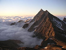
Valle Antrona
Coordinates: 46 ° 4 ′ N , 8 ° 7 ′ E

The Antrona Valley is one of the seven valleys of Ashenvale ( Italian : Val d'Ossola) in the Italian province of Verbano-Cusio-Ossola in the region of Piedmont . The valley is traversed by the mountain river Ovesca .
geography
The Antrona Valley extends from 450 m slm on the Ovesca to 3656 m on the Pizzo d'Andolla (German: Portjengrat) on the border between Italy and Switzerland , or between Antrona Schieranco and Saas-Almagell . The Antronapass connects the valley in the Valais Alps with the Saas valley . The municipalities in the valley are Antrona Schieranco, Montescheno , Seppiana , Viganella and Villadossola at the end of the valley . The valley has 1380 inhabitants on an area of 139.9 square kilometers, which results in a population density of 9.9.
mountains
| Surname | country | height |
|---|---|---|
| Pizzo d'Andolla | IT / CH | 3656 m |
| Pizzo Bottarello | IT / CH | 3487 m |
| Punta di Saas | IT / CH | 3188 m |
| Punta Turiggia | IT | 2811 m |
| Pizzo San Martino | IT | 2733 m |
| Pizzo Montalto | IT | 2705 m |
| Pizzo del Ton | IT | 2675 m |
| Pizzo Ciapè | IT | 2394 m |
Hydrography
There are several streams and lakes in the Antrona Valley. The main drain of the valley is the Ovesca. It rises from Lake Antrona , which was formed in 1642 by a landslide. Today it is a water reservoir that is visited by many tourists on summer weekends. It is fed by the Troncone , which rises on the Pizzo d'Antigine . Shortly before its water reaches the Lago di Antrona, it flows through the Lago Cingino reservoir at 2262 m slm . Here you can also find ibexes looking for moss, grass and, above all, salts in the almost vertical dam wall, as the concrete here excretes saltpeter . Other reservoirs are the Lago di Campliccioli and the Lago Camposecco . The Loranco , one of the most important tributaries of the Ovesca, has its source at Pizzo d'Andolla and a short time later it is dammed into Lago Alpe dei Cavalli (also called Lago di Cheggio ). It flows into the Ovesca at Antronapiana. Another important tributary is the Brevettola , which rises on the slopes of Pizzo San Martino and flows into the Ovesca at Montescheno. After Villadossola this flows into the Toce in the Val d'Ossola.

Landmarks and monuments
The first fraction in the valley is Cresti , seat of the municipality of Montescheno, where the old parish church of Santi Giovanni Battista e Carlo is located. From here a side street leads to Sasso , Barbuniga , Vallemiola and Valleggia . The Zonca fraction , where 2 old wine presses are located, can only be reached on foot. In Vallemiola you will find the oratorio Madonna delle Grazi and also 2 large, old wine presses. One can also be found in Barbuniga , dating from 1745. After passing Montescheno, you come to the village of Seppiana, which used to be the only municipality in the valley. Here is the old parish church of Sant'Ambrogio , which was built in the 11th century . There are also several old buildings with wall paintings in the center of Seppiana. In the Selve fraction you can find a crucifix from the 12th century in the oratory of San Rocco from the 17th century . Further up in the valley is the village of Viganella, which, due to the low level of sunlight, wants to erect a 40 square meter mirror, which should provide the village square with sunlight for several hours a day. The center of Viganella is home to the parish church of Natività di Maria Vergine from the 16th century . At the top of the Antrona Valley is the municipality of Antrona Schieranco, which consists of the communities of San Pietro , Prabernardo (Inferiore and Superiore), Schieranco , Madonna , Locasca , Rovesca , Antropiana , Antrona Lago , Cheggio , Ronco , Arvina and Cimallegra . In Madonna you can find the Beata Vergine del Carmine church from the 16th century, in Antropiana the church of San Lorenzo from the 13th century . From here you can get to Cheggio , where there is a ski lift and a moving walkway .
history
The Ashenvale, together with the Valle Antrona, was occupied twice by the old Swiss Confederation and was a common rule . After the battle of Marignano in 1515, the Confederates had to cede the valley to the then French- ruled Duchy of Milan .
economy
The valley lives mainly from tourism. In the past, mining played a major role. Gold mines were operated from 1736 to 1936 and mica was mined from 1922 to 1960 . The use of water power began at the beginning of the 20th century .
climate
The climate in Valle Antrona is usually alpine with long, hard and snowy winters with cool and rainy summers. Rainfall is plentiful here and the valley is one of the wettest areas in Italy. Especially in autumn there is heavy rainfall, so that there are frequent floods and landslides. Snow covers most of the time the peaks and in the coldest months also the valley.


