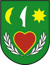
Veľké Uherce
| Veľké Uherce | ||
|---|---|---|
| coat of arms | map | |

|
|
|
| Basic data | ||
| State : | Slovakia | |
| Kraj : | Trenčiansky kraj | |
| Okres : | Partizánske | |
| Region : | Horná Nitra | |
| Area : | 27.788 km² | |
| Residents : | 2,017 (Dec. 31, 2019) | |
| Population density : | 73 inhabitants per km² | |
| Height : | 230 m nm | |
| Postal code : | 958 41 | |
| Telephone code : | 0 38 | |
| Geographic location : | 48 ° 36 ' N , 18 ° 26' E | |
| License plate : | PE | |
| Kód obce : | 505722 | |
| structure | ||
| Community type : | local community | |
| Administration (as of November 2018) | ||
| Mayor : | Alena Chalupová | |
| Address: | Obecný úrad Veľké Uherce č. 360 958 41 Veľké Uherce |
|
| Website: | www.velkeuherce.sk | |
| Statistics information on statistics.sk | ||
Veľké Uherce (Hungarian Nagyugróc ) is a municipality in the west-center of Slovakia with 2017 inhabitants (as of December 31, 2019), which belongs to the Okres Partizánske , part of the Trenčiansky kraj .
geography
The community is located in the upper valley of the Nitra , at its left bank tributary Drahožica , which also supplies the small reservoir called Veľké Uherce above the village. Large parts of the municipality are located in the Tribeč Mountains , which are protected as part of the Ponitrie Protected Landscape Area . The center of the village lies at an altitude of 230 m nm and is six kilometers east of Partizánske .
history
The place was first mentioned in writing in 1274 as Vgrych .
population
Results of the 2001 census (1964 inhabitants):
|
By ethnicity:
|
By denomination:
|
Attractions
- Romantic style castle with an English park
- Church from the 14th century, remodeled in the 17th century in the Renaissance style

