Chynorany
| Chynorany | ||
|---|---|---|
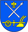
| coat of arms | map | |

|
|
|
| Basic data | ||
| State : | Slovakia | |
| Kraj : | Trenčiansky kraj | |
| Okres : | Partizánske | |
| Region : | Horná Nitra | |
| Area : | 10.351 km² | |
| Residents : | 2,726 (Dec. 31, 2019) | |
| Population density : | 263 inhabitants per km² | |
| Height : | 178 m nm | |
| Postal code : | 956 33 | |
| Telephone code : | 0 38 | |
| Geographic location : | 48 ° 36 ' N , 18 ° 16' E | |
| License plate : | PE | |
| Kód obce : | 543004 | |
| structure | ||
| Community type : | local community | |
| Administration (as of November 2018) | ||
| Mayor : | Mária Lachkovičová | |
| Address: | Obecný úrad Chynorany Cintorínska 45/12 95833 Chynorany |
|
| Website: | www.chynorany.sk | |
| Statistics information on statistics.sk | ||
Chynorany (Hungarian Kinorány - until 1907 Chinorán ) is a municipality in western Slovakia .
location
It is located in the Danube Hills on the northern bank of the Nitra , between the towns of Partizánske (10 km away) and Topoľčany (12 km away). The place has a train station on the Nové Zámky – Prievidza railway line and the line to Trenčín branches off in the place.
history
The place was first mentioned in 1387 as Herenen .
There is a Catholic church in the village from 1784–87.
Web links
Commons : Chynorany - collection of images, videos and audio files

