Vertain tip
| Vertain tip | ||
|---|---|---|
|
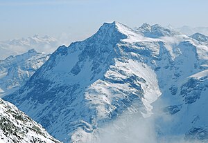
The Vertainspitze from the Königsspitze seen from |
||
| height | 3545 m slm | |
| location | South Tyrol , Italy | |
| Mountains | Ortler Alps | |
| Notch height | 422 m ↓ Madritschjoch | |
| Coordinates | 46 ° 32 '14 " N , 10 ° 38' 8" E | |
|
|
||
| First ascent | August 28, 1865 by Julius Payer, led by Johann Pinggera , and an unknown carrier | |
| Normal way | from Sulden via the southeast ridge and Rosimjoch to the summit | |
The Vertainspitze ( Italian Cima Vertana ) is at 3545 meters the highest mountain of the Lasa Mountains in the Ortler Alps , a mountain range in the southern Eastern Alps . It is located in the Italian province of South Tyrol and is part of the Stilfserjoch National Park . To the northeast, southeast and northwest, the tip sends pronounced and walkable ridges. Because of its impressive panoramic view on all sides and its easy accessibility by cable cars, it is a summit often climbed from Sulden, even in winter. The Vertainspitze was first climbed on August 28, 1865 by Julius Payer , the mountain guide Johann Pinggera , and a porter who was not known by name and who had joined them.
Surroundings
Glaciers meet the Vertainspitze from the north, east and south . The most important in the east is the Laaser Ferner , which reaches up to an altitude of 3350 meters. To the north is the Zayferner , which covers the steep northern flank of the peak as an imposing hanging glacier. A little further away is the Rosim-Ferner to the south . Adjacent peaks are in the course of the northeast ridge , separated by the Angelusscharte crossing (3337 meters), the 3521 meter high Hohe Angelus and in the course of the southeast ridge , separated by the Rosimjoch (3288 meters), the Schildspitze , with a height of 3461 meters. To the west, the terrain falls with the vertain walls down into the Zaytal , a side valley that stretches from the inner Suldental to the northeast. The east side of Lasa also drains north into the Laas valley , which flows into the Vinschgau about 10 kilometers north-northeast near Lasa . The most important place of the area surrounding the Vertainspitze is about four kilometers as the crow westernmost Solda .
Base and ascent
The path from Payer, Pinggera and their unknown porter who joined them, as well as the mountain guide Veit Reinstadler in 1865, led from Sulden in the southwest at the Gampenhöfen into the Rosimtal and from there to the Rosimboden at an altitude of about 2,450 meters. From the report by Louis Friedmann at Eduard Richter : After they had provided themselves with wood here, they hiked up to the tree line [...] and slept there under a rock. The next morning, with the exception of V. Reinstadler, who was left on Bivouac Square , they set out at 4:30 am . [...] Across the blocks which make up the uppermost part of the mountain, they reached the summit at 7.45am, climbing from block to block. The group climbed the summit via the southwest ridge , which is seldom climbed today.
Today's normal route , the easiest ascent, leads past Rosimferner over the southeast ridge to the summit. The Rosimferner can be reached either from the mountain station of the Suldener Kanzellift at 2348 meters or directly from Sulden. The path, unmarked after reaching the glacier, initially leads north alongside the glacier, later it runs on the glacier directly on its edge. The southeast ridge is reached either by ascending the glacier to just below the Rosimjoch and then to the Rosimjoch itself, or by leaving the glacier much earlier and climbing up through the rubble via clearly recognizable tracks until you meet the path coming from Rosimjoch. The further path runs south and well below the ridge cutting edge, before the last stretch to the summit climbs pathless through large boulder rubble in a northerly direction.
The ascent from the Zaytalhütte ( Düsseldorfer Hütte , Rifugio Serristori , 2721 meters) over the Walterweg is much more difficult .
From the mountain station the path leads in, according to literature, a good 4 hours of walking over the ridge and the Rosimjoch to the summit of the Vertainspitze. 3 to 4 hours are required from the Zaytalhütte.
Literature and map
- Peter Holl: Alpenvereinsführer Ortleralpen , 9th edition, Munich 2003, ISBN 3-7633-1313-3
- Julius Payer: Die Südliche Ortler-Alpen , Justus Perthes, Gotha 1865, supplement 18, page 7, to Dr. August Petermann's Geographical Communications
- Casa Editrice Tabacco , Tavagnacco: Carta topografica 1: 25,000, sheet 08, Ortles-Cevedale / Ortler area
Individual evidence
- ↑ Louis Friedmann in Eduard Richter (ed.): The development of the Eastern Alps , Volume II, Verlag des Deutschen und Oesterreichischen Alpenverein, Berlin 1894, p. 226 f.
- ↑ Peter Holl: Alpine Club Guide Ortleralpen , 9th edition, Munich 2003, p. 284 f, Rz 848 ff.

