Vitibuck
| Vitibuck | ||
|---|---|---|
| height | 458 m above sea level NHN | |
| location | Baden-Wuerttemberg , Germany | |
| Mountains | Black Forest | |
| Coordinates | 47 ° 38 '23 " N , 8 ° 16' 38" E | |
|
|
||
|
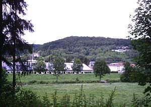
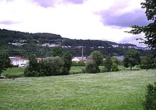
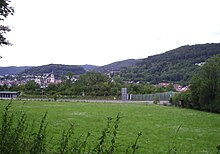
Aerial view over Breitenfeld the Hasenhof (in the foreground) and view over the city of Tiengen and the Vitibuck, in the background the Upper Rhine with the Lauffen near Ettikon and Waldshut. |
||
The Vitibuck is 458 m above sea level. NHN high local mountain of the city of Waldshut-Tiengen and, since the 1950s, the new development area of Tiengen. It is an offshoot of the Hohen Brand ( 627 m above sea level ) and consists of limestone from the Keuper . Gypsum was extracted from the shell limestone in its interior through mining. The Vitibuck Tower is on the summit . The Hochrheinbahn railway line runs along the foot of the southern slope . At the Tiengen train station, the height is 338 m above sea level. NHN , the summit of Vitibuck is 120 meters above the city of Tiengen.
history
The "mountain" belonged to the rulership and was used by the citizens of the city as a garden area in the lower area, while the main part of the southern slope was used for wine-growing. It got its name after the hermits who stayed here , at the end of the 17th century a hermit , Caspar Weissenberger from Erzingen (* 1692; † January 14, 1708) built a small hut on the uppermost, at that time still desolate, landing .
After Caspar Weissenberger's death, the hermit and Franciscan Veit Kraiß, who was born in Frohnstetten in 1684 (formerly the territory of the Buchau women's monastery ), took over the hermitage on the instructions of the Bishop of Constance and was at the pastor's service and looked after the sick in the city until 1745. He died 84 years old in 1768 in Rheinau . His hermitage is said to have had a small bell with which he rang in the salvo in the evening. The place therefore became known and soon Veitbuck, and Vitibuck for the first time in 1769. From 1766 to 1786, a third hermit followed, Fidel Roder, probably from the area. In 1722 he lived in a house on the corner between Brünnele and Heilig-Kreuz-Kapelle , in 1787 he sold it and moved to Bodman , (to Alois Nohl).
At times, therefore, one also wrote Bruderfiedenbuck , but the name Vitibuck has established itself . An interlude occurred around 1800 when the doctor Matthäus Haitz had an ascent path and a viewing platform (Haiztenhöhe) built for the population in the course of the Romantic and Biedermeier periods. After he moved in 1851, his friends had a memorial stone erected. In 1864 the city had a spring on one of the ascent routes, the Osterbrünnele , whose pure water now refreshed many a strolling enthusiast. A Lourdes grotto was built on the same path in the twenties ... this path leads to the hospital (built in 1893, a senior citizens' residence until 2012, acquired by the Hochrhein hospitals in 2013 , planned: accommodation and training location for nursing professions ). A nature park with rare tree and shrub species was created here. In 1923 a cross of honor was erected above the hospital. Every year the gun shooting takes place here on Schwyz Day, and in the past also alphorn players . The New Year's Eve fireworks became an attraction here .
Vitibuck Tower
The path leads past the fallow land of the former Baden farming school to the summit, where a 20-meter-high observation tower was built in 1936. It burned down at the end of August 1975, the new building by the local architect Willi Jockers was inaugurated in September 1979. It is a 37 meter high wooden structure with a covered viewing platform. Depending on the weather, this enables a view over the highest treetops with a clear view over the Küssaburg to the Alps .
cave
There is a karst phenomenon not far from the summit tower . The secondary small cave appears as a ruin-like cave in the shell limestone.
Baden farming school
On November 22, 1931, the Badische Bauernschule was founded by several associations under Lambert Schill as the Badische Bauernschule association after a long renovation phase in Ittendorf Castle and inaugurated in the presence of Minister Andreas Hermes . It was dissolved as early as 1933 and re-established in Schwerzen after the Second World War . With the 4th main course in 1955, the company moved to a spacious new building on the Vitibuck in Tiengen. Previously, the Badischer Landwirtschaftliche Hauptverband eV (BLHV) had received part of the 19,000 square meter property from the city as a gift. The home school, which consists of seven buildings, ceased operations in September 2004. Except for an office building and a hall building opposite, it was demolished. In the meantime, the site has been partially rebuilt, only the former parking lot is still fallow.
Use, leisure
From the former vineyards that existed before 1349, owned by the Counts of Küssenberg , among others , there are still allotment gardens in various forms with garden houses and locations for beekeepers . The summit is completely forested. The westward flattening slope towards Hasenhof and Breitenfeld has largely been built on as a new development area, and is popular due to the view and proximity to the city, new buildings are currently also being built on steep slopes. To the north, towards the valley and Talbach, there was once a shell limestone quarry and the district waste dump. Furthermore, the choir of the Tiengen choir is located in the forest below the observation tower.
Plastering
In the layers beneath the Vitibuck, which is made of shell limestone , the layers of gypsum keuper lie here and in the neighboring Glockenberg there is gypsum that was mined. The plaster of paris was poured into molded stones , so-called "plasterboards", which were used for interior walls in a plaster factory .
See also
literature
- Heinz Voellner, Tiengen, picture of an old town , ed. v. City of Waldshut-Tiengen, 1987
- Axel Bauer, André Frost, Kurt Hoffmann, Tiengen - Encounters with a city , illustrated book, with a text by Hansjoachim Gundelach, 1991, ISBN 3-925016-82-1
- Gustav Adolph Katsch, Vitibuck Roman, 3 volumes, 1865
Individual evidence
- ↑ Voellner (1987), p. 179
- ↑ a b Voellner (1987), p. 180
- ^ Badischer Landwirtschaftlicher Hauptverband eV, Freiburg (ed.): "The way of the farmers' college. Festschrift for the opening of the Badische Bauernschule Tiengen ”, 1955
- ↑ “Farmer School” closes . In: Südkurier of September 29, 2004


