Western Wupperengal
| Western Wupperengal | |||
|---|---|---|---|
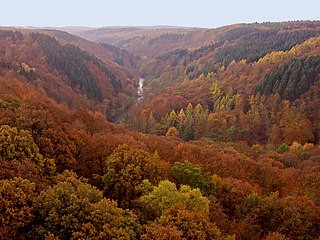
| View from the Müngsten bridge into the Wupperengal | |||
| Systematics according to | Handbook of the natural spatial structure of Germany | ||
| Greater region 1st order | Low mountain range threshold | ||
| Greater region 2nd order | Rhenish Slate Mountains | ||
| Main unit group | 33 → Süderbergland |
||
| About main unit | 338 → Bergische plateaus |
||
| 4th order region (main unit) |
338.0 → Mittelberg plateau |
||
| Natural space |
338.03 → Western Wupperengal |
||
| Geographical location | |||
| Coordinates | 51 ° 9 '59 " N , 7 ° 8' 11" E | ||
|
|||
| local community | Wuppertal , Solingen , Remscheid | ||
| state | North Rhine-Westphalia | ||
| Country | Germany | ||
The western Wupperengal is a natural space unit with the number 338.03 and belongs to the superordinate natural space main unit 338.0 ( Mittelbergische plateau ).
According to the handbook of the natural spatial structure of Germany, the western Wupperengal comprises the meandering narrow valley of the Wupper between Wuppertal - Sonnborn at 130 m above sea level and Solingen - Burg an der Wupper at 100 m above sea level. The river running in north-south direction causes a slope across the mountains of the Southern Uplands, which stretches from west-south-west to east-north-east . The Wupper tributaries with their steep-walled notch valleys , locally called Siepen or Siefen, clearly structure the river valley.
In the area with the strongest local relief at the south end of the natural environment is in spur position the bergische ducal residence Schloss Burg . Other early or prehistoric ramparts or section fortifications (including the ring wall system Burggraben , Wallburg near Müngsten , ring wall system Galapa ) bear witness to the strategic importance of the area assigned to it. In the north near Buchenhofen the valley widens and offers space for the extensive facilities of the Buchenhofen sewage treatment plant .
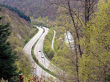
The narrow valley has a strong traffic-inhibiting effect, so that up until the recent past all higher-level traffic routes (Landesstrasse 427, Bundesstrasse 229 , railway line Wuppertal-Oberbarmen-Solingen ) run across it. In terms of construction, the most important valley crossing is the Müngsten Bridge . It was not until the 1970s that a continuous valley road was built with Landesstraße 74 between Sonnborn and Müngsten .
Places in the natural area (following the course of the river)
- Sonnborn
- Lower Rutenbeck
- Buchenhofen
- Evertsaue (departed)
- Peace Valley
- Aue
- Kohlfurther Bridge
- Kohlfurth
- Paper mill
- Grunenburg
- Müngsten
- Switch caps
- Wiesenkotten
- Burg an der Wupper (district Unterburg)


