
Wolfsberg (Sangerhausen)
|
Wolfsberg
City of Sangerhausen
Coordinates: 51 ° 33 ′ 5 ″ N , 11 ° 5 ′ 50 ″ E
|
|
|---|---|
| Height : | 359 m above sea level NHN |
| Area : | 6.79 km² |
| Residents : | 132 (Jan 1, 2013) |
| Population density : | 19 inhabitants / km² |
| Incorporation : | October 1, 2005 |
| Postal code : | 06526 |
| Area code : | 034658 |
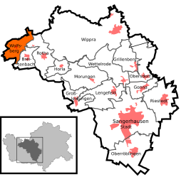  Location of Wolfsberg in Sangerhausen
|
|
.JPG) Center with church
|
|

Wolfsberg is a district of the town of Sangerhausen in the district of Mansfeld-Südharz in Saxony-Anhalt , Germany.
Geographical location
Wolfsberg is located in the Lower Harz on the road between Hayn (Harz) and Rotha .
history
Wolfsberg is in all likelihood a very old place, a knight Konrad von "Wolvisberche" is documented as a witness in a trial in 1199. The origin of the place and castle cannot be proven with certainty. A castle of the same name was built , but it was already desolate at the beginning of the Peasants' War in 1525 and there are no remains of it today.
To the east of the town lies Neuhaus Castle, which is very likely even older than Wolfsburg.
The place originally belonged to the possessions of the Counts of Stolberg . On July 6, 1719, the Wolfsberg office was ceded by Count Christoph Friedrich zu Stolberg-Stolberg to his brother Jost Christian zu Stolberg-Roßla senior and from then on belonged to the County of Stolberg-Roßla . Wolfsberg belonged to the Electorate of Saxony until 1815 and then came to the Merseburg administrative district of the Prussian province of Saxony .
In 1819, 213 people lived in 39 houses in the official village of Wolfsberg. From 1952 to 1990 the place belonged to the GDR district Halle.
Until 2005 Wolfsberg was a politically independent municipality. On October 1, 2005, it was incorporated into Sangerhausen.
Mining

There are different views on how to start mining. In the Stolberg archives there is talk of a visit by Venetian merchants in 1524. The documentation is certain since the beginning of the 18th century, the search for antimony has been mined west of the town. In the course of this, the Graf Jost-Christian-Zeche, located west of Wolfsberg, became known as the only significant antimony deposit in the Harz with the main ore antimonite and as a type locality (or co-type locality) for four minerals : the lead-antimony sulfide plagionite and Zinkenite , the copper antimony sulfide chalcostibite (also copper antimony luster or Wolfsbergite ) and the lead antimony chlorine sulfide dadsonite . In addition, numerous other minerals were found in this mine or on its dumps.
Industry and craft
Mining came to a standstill in 1867. The blacksmith Worch from Silberhütte bought the mine site. Over the years, this forge has developed into an important hardwood sawmill and parquet factory with 40 to 60 employees.
Otherwise there are only 2 craftsmen and 2 small businesses in the village.
traffic
There are bus connections to the surrounding towns.
Individual evidence
- ↑ http://www.sangerhausen.de/ortsteile/wolfsberg
- ↑ StBA: Changes in the municipalities in Germany, see 2005
- ↑ Marko Ranneberg: Der Antimonitbergbau von Wolfsberg ( Memento of the original from December 3, 2013 in the Internet Archive ) Info: The archive link was automatically inserted and not yet checked. Please check the original and archive link according to the instructions and then remove this notice. at pinatubo.net (The heteromorphite given in this source has a different type locality, see Mineralienatlas: Heteromorphit and Handbook of Mineralogy ) (PDF; 62 kB)
- ^ Mineral Atlas - Graf Jost-Christian-Zeche
Web links

Breitenbach | Gonna | Grillenberg | Large lines | Horla | Lengefeld | Morungen | Oberröblingen | Obersdorf | Riestedt | Rotha | Sangerhausen | Wettelrode | Wippra | Wolfsberg