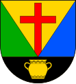
Újezd u Svatého Kříže
| Újezd u Svatého Kříže | ||||
|---|---|---|---|---|
|
||||
| Basic data | ||||
| State : |
|
|||
| Region : | Plzeňský kraj | |||
| District : | Rokycany | |||
| Area : | 435 ha | |||
| Geographic location : | 49 ° 52 ' N , 13 ° 34' E | |||
| Height: | 430 m nm | |||
| Residents : | 243 (Jan. 1, 2019) | |||
| Postal code : | 338 26 | |||
| License plate : | P | |||
| structure | ||||
| Status: | local community | |||
| Districts: | 1 | |||
| administration | ||||
| Mayor : | Josef Kořínek (as of 2006) | |||
| Address: | Újezd u Svatého Kříže 27 338 24 Břasy 1 |
|||
| Municipality number: | 546551 | |||
| Website : | www.ujezdusvatehokrize.cz | |||
| Location of Újezd u Svatého Kříže in the Rokycany district | ||||

|
||||
Újezd u Svatého Kříže (German Aujest bei Heiligenkreuz ) is a municipality with 243 inhabitants (as of January 1, 2019) in the Czech Republic . It is located three kilometers west of the city of Radnice and belongs to the Okres Rokycany . The cadastral area is 435 ha.
geography
The place is located at 430 m above sea level. M. in the headwaters of the Velká Radná, a right tributary of the Berounka . The state road 232 from Břasy to Kozojedy runs through Újezd u Svatého Kříže .
Neighboring towns are Němčovice in the north, Dvorce, Bohemia and Svatá Barbora in the southeast, Radnice in the southeast, Břasy in the south, Vranovice in the southwest,
history
The first written mention of the village comes from 1352. The church was built on the village square in 1777, which characterizes the townscape. In 1885 a two-class school was established. The school house was refurbished for residential purposes in 2006.
Attractions
- The Church of the Holy Cross was built in 1777–1779. In 1902 the painting was supplemented by KV Maška.
- Niche chapel
Web links
- radnicko.cz (Czech)
Individual evidence
- ↑ Český statistický úřad - The population of the Czech municipalities as of January 1, 2019 (PDF; 7.4 MiB)

