Nevid
| Nevid | ||||
|---|---|---|---|---|
|
||||
| Basic data | ||||
| State : |
|
|||
| Region : | Plzeňský kraj | |||
| District : | Rokycany | |||
| Area : | 498 ha | |||
| Geographic location : | 49 ° 41 ' N , 13 ° 36' E | |||
| Height: | 499 m nm | |||
| Residents : | 175 (Jan. 1, 2019) | |||
| Postal code : | 337 01 | |||
| structure | ||||
| Status: | local community | |||
| Districts: | 1 | |||
| administration | ||||
| Mayor : | Václav Tomášů (as of 2007) | |||
| Address: | Nevid 14 337 01 Rokycany 1 |
|||
| Municipality number: | 541192 | |||
| Website : | www.nevid.rokycansko.cz | |||
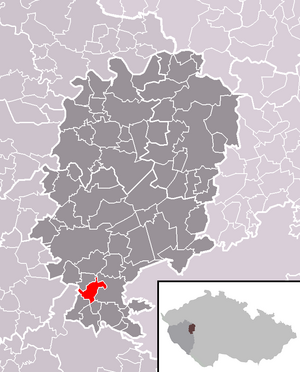
| Location of Nevid in the Rokycany district | ||||

|
||||
Nevid (German Newid ) is a municipality with 175 inhabitants (as of January 1, 2019) in the Czech Republic . It is located six kilometers south of Rokycany in the Brdywald and belongs to the Okres Rokycany . The cadastral area is 498 ha.
geography
The place is located at 499 m above sea level. M. in the western Brdywald. To the east of Nevid lies the Kamínky Nature Park and to the west, as far as the Úslava Valley, is an extensive forest area in which the ruins of the Lopata Castle and the Kozel Castle are located.
Neighboring towns are Veselá and Raková in the north, Peklo and Hrádek in the northeast, Čtrnáctka and Mirošov in the east, Kamínky, Drážky and Kakejcov in the southeast and Mydlný and Kornatice in the south.
history
Nevid was founded in 1227. As part of the Šťáhlavy manor , the place came to the Duppau of Duppau in the middle of the 15th century . Their Stiahlauer line sold their property including the villages Šťáhlavice, Nezbavětice , Sedlec, Lhota , Neslívy, Nezvěstice , Žákava and Nevid as well as the desert castle Lopata to Jiřík Kokořovec from Kokořov in 1539 . When the Šťáhlavy estate was divided, Nevid belonged to Plzenec , Lhota , Sedlec, Šťáhlavice, Raková and Nezbavětice to the share of Jiří Petr Kokořovec on Šťáhlavy.
In 1710 the Cernin von Chudenic acquired the rule and in 1816 it fell as heir to Christian von Waldstein . After the replacement of patrimonial Nevid became an independent municipality in the Rokitzaner district in 1850.
Camping Holubí kout is located in the forest northeast of the village on Dolný rybník.
Attractions
- historic farmstead with ornate entrance gate
- Chapel in the village square
- Forest castle in Kozel
- Kornatický potok valley in the Brdy Forest with the remains of Lopata Castle
Web links
- http://www.nevid.globalweb.cz/ (Czech)

