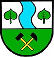
Vejvanov
| Vejvanov | ||||
|---|---|---|---|---|
|
||||
| Basic data | ||||
| State : |
|
|||
| Region : | Plzeňský kraj | |||
| District : | Rokycany | |||
| Area : | 785 ha | |||
| Geographic location : | 49 ° 52 ' N , 13 ° 40' E | |||
| Height: | 456 m nm | |||
| Residents : | 244 (Jan. 1, 2019) | |||
| Postal code : | 338 28 | |||
| structure | ||||
| Status: | local community | |||
| Districts: | 1 | |||
| administration | ||||
| Mayor : | Luboš Špilar (as of 2006) | |||
| Address: | Vejvanov 47 338 28 Radnice u Rokycan |
|||
| Municipality number: | 560227 | |||
| Website : | www.vejvanov.cz | |||
Vejvanov (German Wejwanow ) is a municipality with 244 inhabitants (as of January 1, 2019) in the Czech Republic . It is located four kilometers northeast of Radnice in the Radnitzer Bergland and belongs to the Okres Rokycany . The cadastral area is 785 ha.
geography
The place is located 456 m above sea level. M. in the valley of Vejvanovský potok on the northern edge of the Radnitzer Uplands. To the south, there are extensive forest areas in which the Babská skála (512 m) and the Bechlov (599 m) lie. State road 233 between Břasy and Rakovník runs through Vejvanov .
Neighboring towns are Hlohovice in the north, Hlohovičky and Bílá Skála in the northeast, Biskoupky and Sebečice in the east, Pajzov in the south, Chomle in the west and Mostiště in the northwest.
history
The first written mention of the village comes from 1379, when Jindřich von Vejvanov bought the place from the Kralovice estate. Vejvanov was an insignificant farming village in the Radnice manor until the coal deposit was discovered . In the 19th century, a large number of mines were built in the Chomle -Vejvanov district, which changed the character of the village.
Attractions
- Eight farmsteads in scrap wood construction that are under monument protection
- chapel
- War memorial

