Aegertenbach (Reppisch)
|
Aegerten Bach Ägertenbach |
||
|
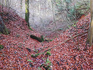
Aegertenbach covered with foliage in the upper part of the ravine |
||
| Data | ||
| Water code | CH : ZH100408 | |
| location | Switzerland | |
| River system | Rhine | |
| Drain over | Reppisch → Limmat → Aare → Rhine → North Sea | |
| source |
Hochrüti in the Honeret forest area 47 ° 22 ′ 44 ″ N , 8 ° 23 ′ 59 ″ E |
|
| Source height | approx. 491 m above sea level M. | |
| muzzle | at the Reppischhof in the Reppisch coordinates: 47 ° 22 '54 " N , 8 ° 23' 44" E ; CH1903: 672 253 / 248310 47 ° 22 '54 " N , 8 ° 23' 44" O |
|
| Mouth height | 427 m above sea level M. | |
| Height difference | approx. 64 m | |
| Bottom slope | approx. 12% | |
| length | approx. 530 m | |
| Catchment area | approx. 18 ha | |
| Communities | Dietikon | |
|
Aegertenbach at the beginning of the ravine |
||
The Aegertenbach (or Aegertenbach ) is an approximately 530 meter long right tributary of the Reppisch in the municipality of Dietikon in the canton of Zurich . Along with the Stoffelbach and the Tobelbach, it is one of the three outflows in the Honeret forest area , which run into Dietikon and flow into the Reppisch.
etymology
The Aegertenächer (or Aegertenacher and until the 1950s Egerten ) area near the Reppischhof , through which the stream flows and which gives it its name , was first mentioned in a document in 1661. In the Alemannic era, the so-called garden economy was operated here, with the piece of land being left to forest for nine years, only to be cleared by fire after this period of time and then cultivated.
This cultivation was carried out until the soil was exhausted and the cycle began again. Later, due to the strong population growth in the 7th century, they switched to the three-field economy . The Egarten economy is reflected today in the field name Aegertenächer and the brook name. The Hochrüti area in the headwaters and the upper reaches of the stream also suggests that this area was once cleared.
geography
course
The headwaters of the Aegertenbach are in the Hochrüti at approx. 491 m above sea level. M. directly next to the Hochrütistrasse in the southeastern part of the Honeret forest area . It is nestled between the gentle slope of the Honeret hill in the east and a gentle and a maximum of 496 m above sea level. M. high hill in the west. In the south, on the other hand, the area falls relatively steeply to around 465 m above sea level. M. into the Fischerhölzli .
At the beginning, the brook makes a small curve to the northwest in a little dug bed, whereby it turns to the right from the Hochrütistrasse . After a short stream, it is followed by Reppischhaldenstrasse , which branches off from Hochrütistrasse here . The Aegertenbach now enters a small and narrow ravine, which is on the northern slope of the hill and is a maximum of five meters deep. There are several larger boulders here , which are scattered across the stream bed. It turns away from Waldstrasse and partly flows in a westerly direction before the ravine flattens out at Aegertenächer and the stream reaches the Reppisch valley.
There now follows an approximately 130 meter long eingedolter portion in which it simultaneously and one after the other, the two field paths Forrenstrasse and Fischerhölzlistrasse passes under before the stream at a field extends. This is followed by the tracks of the Bremgarten-Dietikon-Bahn and the Bernstrasse between Dietikon and Rudolfstetten-Friedlisberg , which is shown here as Hauptstrasse 1 . Immediately afterwards, the Aegertenbach comes back to the surface for around 20 meters before it rises to 427 m above sea level. M. flows from the right into the lower reaches of the Reppisch , which here forms the border with the canton of Aargau .
history
Until about 1993 the stream flowed into a mill canal , which was built to operate the Reppischmühle at today's Reppischhof . After brisk construction activity, the Aegertenbach was finally led directly into the Reppisch. In 2006, the section between Honeret and the tracks of the Bremgarten-Dietikon Railway in the Aegertenächer was moved under a field. Finally, the mouth was moved about 60 meters down the stream so that the stream no longer joins the Reppisch against the direction of flow.
flora
The headwaters and parts of the middle reaches consist of typical woodruff - beech forest , in the lower reaches with lungwort . Most of the upper course consists of the typical maple - ash forest .
photos
See also
Web links
- Course of the Aegertenbach on GIS Zurich
- Course of the Aegertenbach on the geoserver of the Swiss federal administration
swell
Individual evidence
- ↑ a b Determined by shading in relief above the source drawn on the map, which is higher up through personal observation. Geographic information system of the Canton of Zurich
- ↑ Geoserver of the Swiss Federal Administration ( information )
- ↑ Geographic information system of the Canton of Zurich measured according to contour lines
- ↑ New Year's Gazette from Dietikon 1955. (PDF) Settlement history of Dietikon by Karl Heid. Retrieved November 29, 2015 .
- ↑ Neujahrsblatt von Dietikon 1949. (PDF) Place and field names of Dietikon by Karl Heid. Retrieved November 29, 2015 .
- ^ Layer vegetation mapping of the forests in the canton of Zurich Geographic information system of the canton of Zurich


