Aiteas
| Aiteas | ||

|
||

|
||
| Data | ||
| surface | 92.82 km² | |
| population | 4,020 (2015) | |
| Chefe de Suco | Adelino Soares (election 2009) |
|
| Aldeias | Population (2015) | |
| Bi-Uac | 1,626 | |
| Carlilu | 217 | |
| Rembor | 616 | |
| Umasau | 1,561 | |
|
|
||
Aiteas is an East Timorese Suco in the Manatuto Administrative Office ( Manatuto Municipality ).
geography
| Aiteas | ||
| places | position | height |
| Belbato | 8 ° 32 ' S , 126 ° 0' E | ? |
| Carlilu | 8 ° 32 ' S , 126 ° 0' E | 109 m |
| Lahuoae | 8 ° 31 ' S , 126 ° 0' E | 63 m |
| Rembor | 8 ° 33 ′ S , 125 ° 58 ′ E | 96 m |
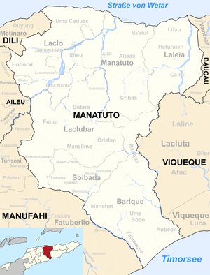
Before the 2015 territorial reform, Aiteas had an area of 82.49 km². Now there are 92.82 km². The Suco is located in the center of the Manatuto administrative office. To the north is the Suco Ma'abat , northwest of the Suco Sau , west of the Suco Ailili and south of the Suco Cribas . In the east of Aiteas lies the administrative office of Laleia with its Sucos Lifau , Haturalan and Cairui . The Sorec River flows through the southeast of Aitea, into which the Lago Lulic , which rises in the Suco, flows. The Sorec meets the Bueana , the border river to Cairui. Both together form the Baunoi and flow further east, where it flows into the Laleia . In the "Three-Suco-Eck" Aileas-Ailili-Cribas the river Lago Birac rises , which flows along the border Ailili-Cribas to the west. It belongs to the Northern Laclos system .
The country road from Manatuto town to Laclubar runs along the border with Ailili . The places Lahuoae , Carlilu ( Carlio ) and Belbato are located in the northeast of the Sucos . Several schools are located here, including the Escola Primaria No.1 Aiteas primary school . The place Rembor came to Aiteas from Iliheu in 2015. It lies between the Northern Laclo and the mouth of the Sumasse. There is also a primary school here.
The four Aldeias Bi-Uac , Carlilu , Rembor and Umasau are located in the Suco .
Residents
The Suco has 4020 inhabitants (2015), of which 2068 are men and 1952 women. The population density is 43.3 inhabitants / km². There are 668 households in the Suco. 77% of the population give Galoli as their mother tongue. Over 14% speak Tetum Prasa , 3% Idaté , minorities Tetum Terik , Habun , Naueti or Baikeno .
history
At the end of 1979 there was an Indonesian camp in Carlilu for East Timorese who were supposed to be relocated by the occupiers for better control.
politics
In the elections of 2004/2005 was Adelino Soares elected Chefe de Suco and in 2009 re-elected.
Web links
- Results of the 2010 census for the Suco Aiteas ( tetum ; PDF; 8.3 MB)
- Results of the 2015 census for the Suco Aiteas (tetum; PDF)
- Seeds of Life: Suco information sheets Manatuto (tetum)
Individual evidence
- ↑ a b c d Direcção-Geral de Estatística : Results of the 2015 census , accessed on November 23, 2016.
- ↑ Fallingrain.com: Directory of Cities, Towns, and Regions in East Timor
- ↑ Direcção Nacional de Estatística: Population Distribution by Administrative Areas Volume 2 English ( Memento from January 5, 2017 in the Internet Archive ) (Census 2010; PDF; 22.6 MB)
- ↑ http://websig.civil.ist.utl.pt/timorgis/Maps@[email protected] ( Memento from June 30, 2007 in the Internet Archive ) Timor-Leste GIS portal
- ↑ List of polling stations for the parliamentary elections in East Timor 2007 (PDF file; 118 kB)
- ↑ Jornal da Républica with the Diploma Ministerial n. 199/09 ( Memento of February 3, 2010 in the Internet Archive ) (Portuguese; PDF; 323 kB)
- ↑ Results of the 2010 census for the Suco Aiteas ( tetum ; PDF; 8.3 MB)
- ↑ "Chapter 7.3 Forced Displacement and Famine" ( Memento of November 28, 2015 in the Internet Archive ) (PDF; 1.3 MB) from the "Chega!" Report of the CAVR (English)
- ↑ Secretariado Técnico de Administração Eleitoral STAE: Eleições para Liderança Comunitária 2004/2005 - Resultados ( Memento of August 4, 2010 in the Internet Archive )
- ↑ Secretariado Técnico de Administração Eleitoral STAE: Eleições para Liderança Comunitária 2009 - Resultados ( Memento of August 4, 2010 in the Internet Archive )
