
Manatuto (Administration Office)
| Manatuto Administration Office | |||
|
|||

|
|||
| Administrative headquarters | Manatuto | ||
| surface | 345.88 km² | ||
| population | 14,392 (2015) | ||
| Sucos | Population (2015) | ||
| Ailili | 1,553 | ||
| Aiteas | 4,020 | ||
| Cribas | 2,435 | ||
| Iliheu | 1,744 | ||
| Ma'abat | 750 | ||
| sow | 3,890 | ||
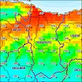
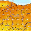
| Overview map | |||

|
|||

Manatuto is an East Timorese administrative office ( Portuguese Posto Administrativo ) in the municipality of Manatuto . The seat of the administration is in Suco Sau in the coastal city of Manatuto . The name is derived from "Manatutu" , the Galoli word for "pecking birds".
geography

Until 2014, the administrative offices were still referred to as sub-districts . Before the 2015 territorial reform, Manatuto had an area of 271.38 km². Now there are 345.88 km².
The Manatuto Administrative Office is on the north coast of Timor on the Strait of Wetar . To the east is the administrative office of Laleia , to the west of Laclo , to the southwest of Laclubar and to the south of Barique . A narrow strip touches the Lacluta administrative office ( municipality of Viqueque ) in the southeast . Manatuto is divided into six sucos: Ailili , Aiteas , Cribas , Iliheu , Ma'abat ( Maabat ) and Sau . The western border forms a long stretch of the Sumasse , which flows into the Northern Lacló in the north, before it flows into the Strait of Wetar in the administrative office. Tributaries of the Laleia flow from the southern administrative office to the east. The Dolacuain flows on the eastern border of the Sucos Ma'abat and several small rivers flow north in the Suco during the rainy season and form the Lagoa Lamessana just before it flows into the sea .
- Climate data
Annual rainfall (2000)
Average annual temperature (2000)

Manatuto climate diagram


Residents
14,392 people (2015) live in the administrative office of Manatuto, 7,327 men and 7,065 women. The population density is 41.6 inhabitants / km². The largest language group are the speakers of the national language Galoli . The average age is 19.4 years (2010, 2004: 19.0 years).
history

Manatuto was one of the traditional kingdoms of Timor, ruled by a liurai . It appears on a list by Afonso de Castro , a former governor of Portuguese Timor who listed 47 empires in 1868. The Dominicans founded a mission here early on . Manatuto was tributary to Luca's empire for a long time, but was able to break away in the second half of the 17th century. They turned to traders from Makassar and even set the Dutch flag . A Topasse fleet ended this alliance and conquered Manatuto, making it part of Portuguese sovereignty again.
The Dominican Manuel de Santo António succeeded in converting the Liurais of Manatuto around 1700.
In 1730, Governor Pedro de Melo made an alliance with the Liurai of Manatuto. For 85 days Melo was besieged by 15,000 enemy warriors in Manatuto until he managed to break out on January 13, 1731. Governor Pedro de Rego Barreto da Gama e Castro established a garrison in the city of Manatuto in the same year. In the 1750s, Timor's second seminary was established here after the seminary in Oecusse . From 1769 to 1877, the bishop for the colony had his seat in Manatuto instead of the capital Dili.
Governor Feliciano António Nogueira Lisboa (1788 to 1790) got into an argument with the monk Francisco Luis da Cunha , the representative of the Catholic Church in Manatuto. Both accused each other of robbery and the theft of customs revenue, among other things. To get rid of the governor, the monk incited the people of Manatuto to rebellion. Christianized Timorese threatened to spread the revolt to all of Belu . Finally, the Viceroy of Goa took action , had both men arrested and deported from Timor. The new governor Joaquim Xavier de Morais Sarmento (1790 to 1794) brought the situation back under control.
On December 31, 1975, Indonesian troops landed in Manatuto during the invasion of East Timor and initially occupied the coast east of the city and the area around the highway to Laclubar. It was only between May and June 1978 that the rest of the then sub-district was conquered by the Indonesians. In Carlilu , Tuquete and the city of Manatuto there were Indonesian resettlement camps for East Timorese at the end of 1979, who were supposed to be resettled by the Indonesian occupiers for better control. In the crisis of 1999 , Manatuto was not spared from destruction either.
politics

The administrator of the administrative office is appointed by the central government in Dili. In 2015 this was António da Silva Soares and from 1994 to 1998 Manuel Vong .
economy

35% of the households in Manatuto grow rice, 35% coconuts, 33% vegetables, 30% cassava, 28% corn and 13% coffee. At Cribas there are small oil deposits, in the north clay and salt are extracted.
Web links
Individual evidence
- ↑ a b c d e Direcção-Geral de Estatística : Results of the 2015 census , accessed on November 23, 2016.
- ↑ Jornal da República : Diploma Ministerial no 24/2014 de 24 de Julho - Orgânica dos Postos Administrativos ( Memento of March 4, 2016 in the Internet Archive )
- ↑ Geoffrey Hull : The placenames of East Timor , in: Placenames Australia (ANPS): Newsletter of the Australian National Placenames Survey, June 2006, pp. 6 & 7, ( Memento of the original from February 14, 2017 in the Internet Archive ) Info: The archive link was inserted automatically and has not yet been checked. Please check the original and archive link according to the instructions and then remove this notice. accessed on September 28, 2014.
- ↑ a b Direcção Nacional de Estatística: 2010 Census Wall Chart (English) ( Memento of the original from August 12, 2011 in the Internet Archive ) Info: The archive link was automatically inserted and not yet checked. Please check the original and archive link according to the instructions and then remove this notice. (PDF; 2.5 MB)
- ^ Timor-Leste GIS-Portal ( Memento from June 30, 2007 in the Internet Archive )
- ↑ a b c Seeds of Life
- ↑ Direcção Nacional de Estatística: Census of Population and Housing Atlas 2004 ( Memento of November 13, 2012 in the Internet Archive ) (PDF; 14 MB)
- ↑ TIMOR LORO SAE, Um pouco de história ( Memento of the original dated November 13, 2001 in the Internet Archive ) Info: The archive link was inserted automatically and has not yet been checked. Please check the original and archive link according to the instructions and then remove this notice.
- ↑ East Timor - PORTUGUESE DEPENDENCY OF EAST TIMOR ( Memento of February 21, 2004 in the Internet Archive )
- ↑ a b Hans Hägerdal: Rebellions or factionalism? Timorese forms of resistance in an early colonial context, 1650-1769
- ↑ Susana Barnes, Hans Hägerdal, Lisa Palmer: An East Timorese Domain - Luca from Central and Peripheral Perspectives , p. 335, 2017, DOI: 10.1163 / 22134379-17302020 , accessed on November 22, 2017.
- ^ Artur Teodoro de Matos: D. Frei Manuel de Santo António: missionário e primeiro bispo residente em Timor. Elementos para a sua biografia (1660–1733) ( Memento of the original from May 25, 2013 in the Internet Archive ) Info: The archive link was inserted automatically and has not yet been checked. Please check the original and archive link according to the instructions and then remove this notice. (Portuguese)
- ↑ History of Timor ( Memento of the original from March 24, 2009 in the Internet Archive ) Info: The archive link was automatically inserted and not yet checked. Please check the original and archive link according to the instructions and then remove this notice. , P. 50 - Technical University of Lisbon (PDF file; 805 kB)
- ↑ Chronologie de l'histoire du Timor (1512–1945) suivie des événements récents (1975–1999) (French; PDF; 887 kB)
- ↑ "Chapter 7.3 Forced Displacement and Famine" ( Memento of the original from November 28, 2015 in the Internet Archive ) Info: The archive link was inserted automatically and has not yet been checked. Please check the original and archive link according to the instructions and then remove this notice. (PDF; 1.3 MB) from the "Chega!" Report by CAVR (English)
- ↑ Ministério da Administração Estatal: Administração Municipal ( Memento of the original from June 1, 2016 in the Internet Archive ) Info: The archive link has been inserted automatically and has not yet been checked. Please check the original and archive link according to the instructions and then remove this notice.
- ↑ Timor Diaspora: Curriculum Vitae , accessed on October 14, 2017.
- ↑ Direcção Nacional de Estatística: Suco Report Volume 4 (English) ( Memento of the original from April 9, 2015 in the Internet Archive ) Info: The archive link was inserted automatically and has not yet been checked. Please check the original and archive link according to the instructions and then remove this notice. (PDF; 9.8 MB)
Coordinates: 8 ° 31 ' S , 126 ° 1' E
The administrative borders within East Timor changed in 2015. This article must therefore be checked and updated if necessary. See New Administrative Boundaries .