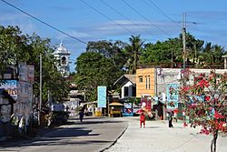
Anda (Bohol)
| Municipality of Anda | ||
 Poblacion |
||
| Location of Anda in Bohol Province | ||
|---|---|---|

|
||
| Basic data | ||
| Region : | Central Visayas | |
| Province : | Bohol | |
| Barangays : | 16 | |
| District: | 3. Bohol District | |
| PSGC : | 071203000 | |
| Income class : | 5th income bracket | |
| Households : | 3072 May 1, 2000 census
|
|
| Population : | 16,462 August 1, 2015 census
|
|
| Population density : | 260.9 inhabitants per km² | |
| Area : | 63.10 km² | |
| Coordinates : | 9 ° 46 ′ N , 124 ° 35 ′ E | |
| Postal code : | 6311 | |
| Mayor : | Paulino T. Amper | |
| Website: | Anda | |
| Geographical location in the Philippines | ||
|
|
||
Anda is a municipality in the Bohol Province of the Philippines . The municipality has 16,462 inhabitants (August 1, 2015 census).
Anda has white sandy beaches and good diving spots. In addition, the shrine of the local saint Potenciana "Inday" Saranza and the few are rock paintings on the Philippines , at the Lamanokspitze worth mentioning that along with the Angono Petroglyphs since 2006 on the list of proposals for the containment, World Heritage of UNESCO are.
Barangays
Anda is politically divided into 16 barangays .
|
|

