
Sikatuna
| Municipality of Sikatuna | |||
| Location of Sikatuna in Bohol Province | |||
|---|---|---|---|

|
|||
| Basic data | |||
| Region : | Central Visayas | ||
| Province : | Bohol | ||
| Barangays : | 10 | ||
| District: | 1. District of Bohol | ||
| PSGC : | 071241000 | ||
| Income class : | 6th income bracket | ||
| Households : | 1177 May 1, 2000 census
|
||
| Population : | 6,726 August 1, 2015 census
|
||
| Population density : | 251.4 inhabitants per km² | ||
| Area : | 26.75 km² | ||
| Coordinates : | 9 ° 41 ′ N , 123 ° 58 ′ E | ||
| Postal code : | 6338 | ||
| Mayor : | Ireneo B. Calimpusan | ||
| Website: | Sikatuna | ||
| Geographical location in the Philippines | |||
|
|||

Sikatuna is a Filipino municipality in the province of Bohol on the island of the same name . It has 6,726 inhabitants (August 1, 2015 census).
Barangays
Sikatuna is politically divided into ten barangays .
|
|
|
history
Sikatuna is a relatively young community that was only founded after the end of the Spanish colonial era on December 5, 1917. Before that, the center of Sikatunas (Poblacion 1 and Poblacion 2) belonged to the neighboring municipality of Alburquerque as Barangay Comago . With Comago's appointment as an independent community, four more barangays from Alburquerque were assigned to it (Libjo, Abucay Sur, Abucay Norte, and Can-agong), as well as two previously to the communities of Loboc (Cambuac Sur and Cambuac Norte) and Balilihan (Badiang and Bahaybahay) ) belonging barangays.
The community was named after Datu Sikatuna , an important chief in the history of Bohol from the 16th century, who formed a blood brotherhood with the Spanish conquistador Miguel López de Legazpi in 1565 .
photos
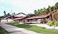
market

Sikatuna


Web links
Individual evidence
- ↑ Source: Mr. FORTUNATO O. AHAT, retired principal of Sikatuna Central Elementary School