
Balilihan
| Municipality of Balilihan | |||
| Location of Balilihan in Bohol Province | |||
|---|---|---|---|

|
|||
| Basic data | |||
| Region : | Central Visayas | ||
| Province : | Bohol | ||
| Barangays : | 31 | ||
| District: | 1. District of Bohol | ||
| PSGC : | 071206000 | ||
| Income class : | 5th income bracket | ||
| Households : | 3101 May 1, 2000 census
|
||
| Population : | 17,903 August 1, 2015 census
|
||
| Population density : | 119.2 inhabitants per km² | ||
| Area : | 150.22 km² | ||
| Coordinates : | 9 ° 45 ' N , 124 ° 1' E | ||
| Postal code : | 6342 | ||
| Mayor : | Victoria Migriño Chatto | ||
| Website: | Balilihan | ||
| Geographical location in the Philippines | |||
|
|||

Balilihan is a municipality in Bohol Province, Philippines . It has 17,903 inhabitants (August 1st 2015 census).
The community got its name from the grass balili , which is abundant in the area. The Balilihan community was founded on September 29, 1828. Before that, the area belonged to the much older Baclayon community .
Barangays
Balilihan is politically divided into 31 barangays .
|
|
|

photos
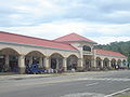
Balilihan Public Market
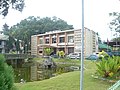
Balilihan Municipal Council

Ceiling painting in the Roman Catholic Church of Balilihan


