Asbach (Bad Hersfeld)
|
Asbach
City of Bad Hersfeld
Coordinates: 50 ° 49 ′ 57 ″ N , 9 ° 39 ′ 55 ″ E
|
|
|---|---|
| Height : | 208 m |
| Area : | 5.51 km² |
| Residents : | 1455 (2004) |
| Population density : | 264 inhabitants / km² |
| Incorporation : | December 31, 1971 |
| Postal code : | 36251 |
| Area code : | 06621 |
|
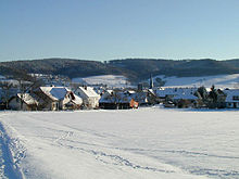
Asbach, northern entrance to the village (1984)
|
|
Asbach is a district of Bad Hersfeld in the Hersfeld-Rotenburg district in East Hesse .
geography
Neighboring places ( clockwise ) are Eichhof in the northeast, Kohlhausen in the east, Kerspenhausen in the southeast and Beiershausen in the south. The municipality of Niederaula borders in the south. Asbach lies in the Fulda valley and is largely surrounded by forest.
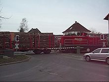
The district can be reached via federal highway 62 , which connects Bad Hersfeld and Niederaula. The Knüllwaldbahn runs through Asbach .
The Asbach ( also known as the Bach in dialect ) rises above Asbach, flows through the village and flows into the nearby Fulda .
history
Asbach was first mentioned in a document in 1073. On December 31, 1971, Asbach was incorporated into the district town of Bad Hersfeld.
Population development
| X: Population from 1834 to 2004 | ||||
|---|---|---|---|---|
| year | Residents | |||
| 1834 | 607 | |||
| 1840 | 685 | |||
| 1846 | 673 | |||
| 1852 | 659 | |||
| 1858 | 654 | |||
| 1864 | 671 | |||
| 1871 | 661 | |||
| 1875 | 636 | |||
| 1885 | 653 | |||
| 1895 | 615 | |||
| 1905 | 697 | |||
| 1910 | 713 | |||
| 1925 | 781 | |||
| 1939 | 918 | |||
| 1946 | 1,049 | |||
| 1950 | 1,272 | |||
| 1956 | 1,197 | |||
| 1961 | 1,127 | |||
| 1967 | 1,080 | |||
| 1970 | 1,185 | |||
| 1980 | ? | |||
| 1994 | 1,427 | |||
| 2004 | 1,455 | |||
| Data source: Historical municipality register for Hesse: The population of the municipalities from 1834 to 1967. Wiesbaden: Hessisches Statistisches Landesamt, 1968. Further sources: 1970 :; after 1950. City of Bad Hersfeld. | ||||
politics
The last local council elections took place in 2016. The chairman of the local council is the mayor Uwe Seitz (SPD).
The election result at a glance:
- SPD 43.3%
- FWG 29.0%
- BLA 27.7%
Economy and Infrastructure
The structural structure of the place is characterized by the old village center, which was gradually expanded to include new building areas. The center of the village is the Protestant church in the center with a long history: Johannes Kohlhäuser was the first Protestant pastor to be documented as early as 1560. Asbach has a municipal kindergarten and a primary school. Social life is shaped by several clubs : the Spielverein Asbach-Bad Hersfeld 1928 e. Founded in 1928. V. , boys and girls' association Randelsried-Asbach e. V., the trombone choir, the men's and women's choir, the rural women, the fruit and horticultural association and the volunteer fire brigade .
Asbach is predominantly the residence of commuters. Some full-time and part-time farmers as well as craft businesses, service providers and logistics companies are based on site. The main warehouse of the online mail order company Amazon is located between Asbach and Eichhof . Due to the central location of Asbach within Germany and the easy accessibility of the federal highways 4 , 5 and 7 , the area is very suitable for logistics companies.
traffic

Asbach is integrated into the public transport system of the Bad Hersfeld-Rotenburg district, which in turn is connected to the North Hessian Transport Association (NVV). There used to be a train station in Asbach, today only freight trains run on the Knüllwaldbahn . There is access to the ICE network of Deutsche Bahn via the Bad Hersfeld train station, which is 4 km away .
Road traffic connections exist via the federal highway 62 and the federal highways 4 , 5 and 7 .
The Frankfurt airport is 150 km away.
tourism
The forest and hiking trails leading around the district and the excellent view of the surrounding communities are particularly attractive for tourists.
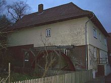
The overshot waterwheel on the old water mill in Mühlestrasse was restored for tourism and to enrich the village. In the summer months you can have water pumped into the wooden gutter at the push of a button, and the water wheel then turns for a few seconds.
To the west of Asbach, in the Asbachtal, is the Milnrode castle ruin , which can be easily reached on foot. Not far away from the castle ruins are the remains of the Pfaffenwald forced labor, death and abortion camp built in the Third Reich .
Hotel rooms are available. Ahle sausage is one of the culinary specialties . Cultural highlights of Bad Hersfeld, such as the Lullus Festival and the Bad Hersfeld Festival , can be reached from Asbach within a few minutes.
Individual evidence
- ↑ a b c d Asbach, Hersfeld-Rotenburg district. Historical local dictionary for Hessen. (As of October 16, 2018). In: Landesgeschichtliches Informationssystem Hessen (LAGIS).
- ^ Federal Statistical Office (ed.): Historical municipality directory for the Federal Republic of Germany. Name, border and key number changes in municipalities, counties and administrative districts from May 27, 1970 to December 31, 1982 . W. Kohlhammer GmbH, Stuttgart and Mainz 1983, ISBN 3-17-003263-1 , p. 396 .
- ^ Local advisory board of the Asbach district. In: website. City of Bad Hersfeld, accessed October 2019 .
Web links
- Web presence of the city of Bad Hersfeld
- Asbach. Info. In: www.asbachhef.jimdo.com. Asbach local advisory board
- Asbach, Hersfeld-Rotenburg district. Historical local dictionary for Hessen. In: Landesgeschichtliches Informationssystem Hessen (LAGIS).


