Ausoniusstrasse (Römerstrasse)
| Ausoniusweg |
|
|---|---|
 Ausoniusweg just before Weiler near Bingen |
|
| Data | |
| length | approx. 118 km |
| location |
|
| Markers | White "AU" on a green background |
| Starting point |
Klopp Castle , Bingen am Rhein 49 ° 57 ′ 58.8 ″ N , 7 ° 53 ′ 47.7 ″ E |
| Target point |
Porta Nigra , Trier 49 ° 45 ′ 34.9 ″ N , 6 ° 38 ′ 38.5 ″ E |
| Type | Long-distance hiking trail |
| season | all year round |


The Ausoniusstraße or the Ausoniusweg was a Roman road that led from Trier via the Hunsrück to Bingen am Rhein to the Rheintalstraße and thus on to Mainz ( Mogontiacum ). The route is now developed as a hiking trail that is maintained by the Hunsrück Association. The waymark is a white AU on a green background.
Name and description
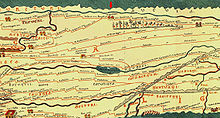
An ancient name of the route mentioned in Tacitus is not known. The route is marked on the Tabula Peutingeriana , a copy of a Roman road map from the 4th century. The Roman poet and civil servant Decimus Magnus Ausonius toured the area between 365 and 368 and described the journey from Bingen to Trier in his poem Mosella . The naming of the route after Ausonius, however, only became common in the 20th century. The mostly straight path was lined with Roman settlements, was self-paved and even two-lane expanded. It is not known whether the path was marked with Leugensteinen ( milestones ). Since today's roads (for example the Hunsrückhöhenstrasse and the federal road 50 and before Bingen the country road 214) run along the route, the hiking trail is often led on parallel, hiking-suitable routes. The typical straight course of the route between the Stumpfen Turm and Kirchberg - Denzen is particularly clear .
Since June 2013 the Ausoniusweg has also been dedicated as the Hunsrücker Jakobsweg , as it was already used as a pilgrimage route in the Middle Ages.
course
The Ausoniusweg is approx. 118 km long and today as a hiking trail mostly leads over dirt roads. It connects the Middle Rhine Valley (Bingen) with Trier. For a hike with a daily output of 20 km / d, a stop is recommended in the following places:
-
Bingium ( Bingen )
- 22 km
-
Rheinböllen
- 23 km
-
Dumnissus ( Denzen ), today part of Kirchberg
- 17 km
-
Hochscheid
- 5 km
-
Belginum Archaeological Park , (open-air museum)
- 17 km
-
Gräfendhron
- 21 km
-
hide
- 13 km
- Augusta Treverorum ( Trier )
An alternative ascent begins in Neumagen-Dhron , identical to the Moselhöhenweg and leads over the Weinplatz near Horath . At Morbach - Elzerath (Heidenpütz) this original route meets the hiking trail coming via Trier, Pfalzel, Fell, Gräfendhron. From Trier onwards, the distance is seven kilometers longer.
Other towns along the route are the towns of Simmern , Stromberg and the towns of Waldalgesheim and Weiler . Here, however, the hiking trail runs parallel to Rheinböllen and Erbach am Binger Wald . The direct route formerly led via Stromberg and from Weiler through the Im Bangert valley to the Roman Nahe bridge, which was then closer to the mouth of the Nahe (? Drusus bridge ).
construction
The long-time director of the Roman-Germanic Central Museum in Mainz, Karl Schumacher, describes the structure of Römerstrasse as follows: “The substructure is a 1.50 meter high dam, the soil of which is taken from the trenches, which in many places are still closed on both sides are seen. The strongly curved roadway was 5 to 5.50 meters wide, the embankment on both sides of about 1.50 meters each. The stone packing is about 80 centimeters thick and clearly shows two road bodies on top of each other, which are separated from each other by a so-called layer of leaves. It is a real pleasure to hike along the almost dead straight dam through forest and heather ... "
literature
- Uwe Anhäuser: The Ausoniusstrasse. An archaeological travel and hiking guide. Rhein-Mosel-Verlag, Alf, 2006, ISBN 3-89801-032-5 .
- Heinz Cüppers : Ausoniusstrasse. In: H. Cüppers (Ed.): The Romans in Rhineland-Palatinate. Licensed edition, Nikol, Hamburg 2005, ISBN 3-933203-60-0 , pp. 310-312.
- Paul Dräger (Ed.): Mosella (Latin-German). among others: Paulinus-Verlag, Trier, 2001, ISBN 3-87760-167-7 .
Web links
- Leisure map Rhein-Hunsrück with Ausoniusstraße (movable)
- Hans H. Stassen: Sights worth seeing on Sironaweg: Ausoniusstraße: An old Roman path. Sironaweg.de, archived from the original on January 4, 2011 ; Retrieved April 23, 2017 .
- Michael Schönherr: The Ausoniusstraße between Bingen and Stromberg. Matthias Schönherr's website, June 10, 1999 (PDF; 1.5 MB).
- On the trail of Ausonius. Website of the Verbandsgemeinde Kirchberg, 2013, archived from the original on July 15, 2012 ; Retrieved on April 23, 2017 (exemplary touristic section (circular route) near Sohren ).
Individual evidence
- ^ Regional group Hunsrück of the Jakobusgesellschaft
- ↑ Quoted without further details (and without giving their current names) in Rudolf Pörtner : Kelten, Römer, Sarmaten. In the Hunsrück. Merian Heft 6 / XV (1962), pp. 68-70.