
Stream and gorge forest near Untermässing
|
Stream and gorge forest near Untermässing
|
||
 Entrance to the nature reserve |
||
| location | Undermassing | |
| surface | 12.2 ha | |
| Identifier | NSG-00447.01 | |
| WDPA ID | 162312 | |
| Geographical location | 49 ° 6 ′ N , 11 ° 19 ′ E | |
|
||
| Setup date | May 29, 1993 | |
| administration | District of Roth | |

The creek and ravine forest in Untermässing is a nature reserve in Untermässing , a district of Central Franconia town of Greding in the district of Roth in Bavaria .
location
The nature reserve is located in the Altmühltal Nature Park, around 2 kilometers northeast of Untermässing and 1.5 kilometers south of Obermässing . It is located in the Kreuzfeldgraben valley between the Bürschelleite and Katzenberg mountains .
description
The area is a designated, 12.2 hectare nature reserve and has the cadastral number NSG-00447.01. It is part of the Fauna-Flora-Habitat- Area Trauf of the southern Franconian Jura (FFH-No. 6833-371; WDPA-No. 555521725) and of the protected landscape area in the Altmühltal Nature Park (LSG-No. LSG-00565.01; WDPA-No. 396115).
The nature reserve is located in a wooded hillside on the upper reaches of the Kreuzfeldbach, a side stream of the Schwarzach . The stream rises in the source area of the Ornatentons . It runs through the geological layers of the night eaves and has partially dug itself deep into them. The stream is fed from several source horizons . Again and again one finds tufa formations at the source outlets, which have developed as flat and moss-covered tuff terraces. The terraces owe their creation to the lime dissolved in the spring water, which is deposited on mosses and coats the streams in a thick layer.
Until 1912, Österberg's emergency water supply was located on the upper reaches of the brook . In dry years the farmers transported the good spring water in the Burschl with the help of animal teams.
Flora and fauna
In the upper slope, impressive ravine forests grow on the steep slopes, in the lower slope mixed alder , ash and wet forests grow. In the forest-free lower slope, the stream is lined with light trees with a riparian forest character . On a small scale, these dovetail with flat moor areas and spring waterlogging. Here you can find orchids , calopterygidae , Spring frogs and other rare animal and plant species.
Sinter terraces in Heinrichsgraben

There is a similar valley cut about 1.5 kilometers to the south. The Heinrichsgraben is designated as a geotope and protected landscape component. Here in Heinrichsgraben rises on the Malm lower limit a lime-rich source that feeds the small Schmiedackerbach in the ditch. The high lime content causes tuff precipitation in small mossy cascades over a length of around 100 meters.
Access
The nature reserve is freely accessible all year round. A less paved path leads along the course of the stream and is marked as a hiking trail.
In spring it is worth visiting because of the flowering aspects and the rich vegetation. There are no parking spaces on site.
Picture gallery

The hiking trail through the NSG

Limestone terraces

Limestone terrace, detailed view

Stream, sintered
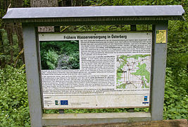
Information board


Individual evidence
- ↑ Government Gazette Middle Franconia, ordinance, nature reserve Bach and Schluchtwald near Untermässing (accessed on January 31, 2016)
- ↑ Information board on site, see Commons
- ↑ Geotope: Sinter terraces in Heinrichsgraben SE von Untermässing (accessed on January 31, 2016)
Web links
- Government of Middle Franconia, nature reserve Bach and Schluchtwald near Untermässing (accessed on January 31, 2016)
- Location of the NSG "Bach und Schluchtwald bei Untermässing" in OpenStreetMap (accessed on January 31, 2016)
