
Reservoir root of the Rothsee
|
NSG dam of the Rothsee
|
||
 The nature reserve near Polsdorf |
||
| location | Allersberg , Roth , District of Roth , Bavaria | |
| surface | 46 ha | |
| Identifier | NSG500.040 | |
| WDPA ID | 165657 | |
| Geographical location | 49 ° 14 ' N , 11 ° 12' E | |
|
||
| Setup date | April 10, 1992 | |
| administration | District of Roth | |

The dam of the Rothsee is a nature reserve on the Rothsee ( Vorsperre ) in the Central Franconian district of Roth , Bavaria .
location
The nature reserve is located on the northeastern part of the Rothsee pre-dam, about two kilometers southwest of Allersberg and four kilometers north of Hilpoltstein , between the Allersberg districts of Polsdorf and Fischhof .
description
The area is a designated 46 hectare nature reserve and has the cadastral number NSG500.040. It is a combination of silting zones , alluvial forests and open water areas. When construction work on the Rothsee system began in the late 1970s, the area partially swamped. Small, inaccessible islands were created there, consisting of the accumulated root stocks and the humus cover spoil from the clearing phase . As bird protection zones , these offer a refuge for water-loving ground breeders, for example .
The trapped with 0.8 hectare Eulenhof - Weiher was first mentioned in the 17th century and from the from the east flowing Schoenbrunn stream fed.
In the 1990s, the inlet area, the reservoir of the Kleine Roth and the adjoining open water area were placed under protection.


Flora and fauna
The shores of the lake consist of reeds and large sedge areas, which were shielded by wood fringes and wire fences. The area forms a shelter and breeding area for numerous species of birds and countless amphibious animals. When calm returned after the construction work was completed, large mammals such as deer and wild boar migrated back to the area and use it as a nursery and watering place. However, it is quite common for individual individuals to have accidents on the ICE route immediately to the east and federal motorway 9 , as well as on the heavily frequented St 2237 to the north . The area is also known for its numerous colonies of wild rabbits , which can nest well in the sandy soils and find a rich food supply there. These in turn, like the breeding birds and the fish stocks in the Rothsee, provide the basic food for stable populations of birds of prey and foxes .
The storks are absent from the habitat despite the varied menu. Directly above the area, two important international air corridors cross, which are only flown a few minutes apart. Airplanes that approach Nuremberg from the south for landing have already descended above the Rothsee from their cruising altitude to below 10,000 feet, and rescue and police helicopters use the nearby ICE / BAB9 route or the Main-Danube Canal as landmarks for visual flight. As a result, the airspace is permanently too restless, so that the storks avoid the whole area widely.
Access
The Rothsee is fully accessible with a circular cycle and footpath. This crosses and also leads directly along the north and south borders of the protected area. The area is closed with a wire fence and partially natural with hedges. The habitats are clearly visible from the path; access to the protected area itself is not permitted. To the south of the area near Polsdorf is an information pavilion of the State Association for Bird Protection
A birdwatching visit is especially worthwhile in spring and autumn.
Parking spaces, some of which are subject to a fee, are located on the dam between the main barrier and the pre-barrier at Birkach and on the state road St 2225 .
With the public transport ( VGN ) the journey is z. B. possible via Allersberg and Polsdorf. From there it is about 5 minutes on foot along the riverside path.
Surroundings
About three kilometers away, at the western end of the Rothsee, there is another nature reserve, the northwest bank of the Rothsee main barrier .
The surroundings of the Rothsee offer numerous leisure activities such as sailing, surfing, swimming, cycling and hiking. Near Grashof on the south bank and opposite on the north bank are beaches with a restaurant each.
Picture gallery
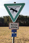
NSG shield
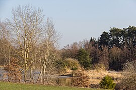
The north bank
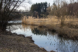
A pond on the south bank
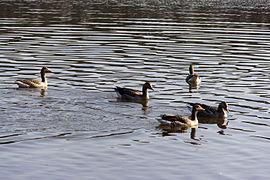
Greylag geese in March

Swan pair in March


Individual evidence
- ↑ Bavarian State Ministry of Environment and Health, NSG500.040 Nature Reserve Stauwurzel des Rothsee (accessed on March 9, 2013)
Web links
- Government of Middle Franconia, Stauwurzel nature reserve (accessed March 9, 2013)
- Rothsee webpage (accessed on March 3, 2013)
- Location of the NSG "Stauwurzel des Rothsee" in OpenStreetMap (accessed on January 31, 2016)
- www.landratsamt-roth.de, Ordinance on the reservoir root of the Rothsee
