Belén District (Maynas)
| Belén district | ||
|---|---|---|
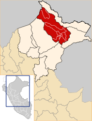
 The Belén district is located in the central southeast of Maynas Province |
||
| Symbols | ||
|
||
| Basic data | ||
| Country | Peru | |
| region | Loreto | |
| province | Maynas | |
| Seat | Belén | |
| surface | 611 km² | |
| Residents | 69,608 (2017) | |
| density | 114 inhabitants per km² | |
| founding | November 5, 1999 | |
| ISO 3166-2 | PE-LOR | |
| Website | www.munibelen.gob.pe (Spanish) | |
| politics | ||
| Alcalde District | Gerson Lecca García (2019-2022) |
|
| Political party | Restauración Nacional | |
| View of Belén | ||
Coordinates: 3 ° 46 ′ S , 73 ° 16 ′ W
The Belén District is a district in the Maynas Province in the Loreto region in northeastern Peru . The district founded on November 5, 1999 was created from parts of the district of Iquitos . The district has an area of 611 km². The 2017 census counted 69,608 inhabitants. Ten years earlier, the population was 68,806. The administrative center is the 110 m high town of Belén , a south-western suburb of Iquitos with 61,158 inhabitants (as of 2017).
Geographical location
The Belén district is located in the Peruvian Amazon in the east of the Maynas province. It stretches on both sides of the Amazon .
The Belén district is bordered to the west by the San Juan Bautista , Iquitos and Punchana districts , to the northeast by the Indiana district and to the southeast by the Fernando Lores district .
Web links
- Municipalidad Distrital de Belén
- Peru: Region Loreto (provinces and districts) at www.citypopulation.de
- INEI Perú

