Bira (river)
|
Bira Бира́ |
||
|
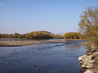
The Bira in Birobidzhan |
||
| Data | ||
| Water code | RU : 20030600112118100050308 | |
| location | Jewish Autonomous Oblast ( Russia ) | |
| River system | Amur | |
| Drain over | Amur → Tatar Sound | |
| origin | Confluence of the Kuldur and Sutara rivers 48 ° 58 ′ 48 ″ N , 131 ° 41 ′ 2 ″ E |
|
| Source height | 216 m | |
| muzzle |
Amur coordinates: 48 ° 9 '26 " N , 133 ° 17' 11" E 48 ° 9 '26 " N , 133 ° 17' 11" E |
|
| Mouth height | 44 m | |
| Height difference | 172 m | |
| Bottom slope | 0.41 ‰ | |
| length | 424 km | |
| Catchment area | 9580 km² | |
| Left tributaries | Bolshaya Kamenuschka, Nikita, Sagdy-Bira, Ikura | |
| Medium-sized cities | Birobidzhan | |
| Small towns | Birakan , Teploosjorsk , Londoko , Bira | |
| Communities | Waldheim , Naifeld | |
The Bira ( Russian Бира ) is a 424 km long left tributary of the Amur in the Jewish Autonomous Oblast ( Russia ).
course
The Bira arises at a height of 216 m in the middle of the Small Hinggan Mountains a few kilometers west of the urban-type settlement Birakan from the source rivers Kuldur from the left and Sutara (also Sutar ) from the right. The 60-kilometer-long Kuldur comes from the north, where it rises on the main ridge of the low mountain range several dozen kilometers away on the border with the Khabarovsk region at an altitude of about 600 m , while the 123-kilometer-long Sutara has its origin a good 60 kilometers as the crow flies in a southwestern direction on the Sutara crest (Sutarski chrebet) , named after her, to the southeast .
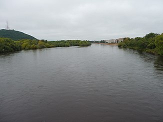
The Bira initially flows in a relatively wide valley in an easterly direction and, after reaching the plains of the Amur lowlands, turns south. In some sections it meanders strongly, in wide arches at the middle reaches, so that the river length more than doubles the distance covered by air line. The river flows below Leninskoje into the left arm (Protoka Golowinskaja) of the Amur, whose main arm, which runs across several islands, marks the border between Russia and the People's Republic of China . Near the mouth, the Bira is up to 200 meters wide; the flow velocity there is 0.8 m / s.
The most important tributaries are the Bolschaja Kamenuschka (Great Kamenuschka), Nikita, Sagdy-Bira and Ikura, all of which flow from the left into the upper middle reaches of the Bira.
The name of the river is believed to be derived from the Evenk word for river . Sometimes it is also called Big Bira (Bolshaya Bira) to distinguish it from Small Bira (Malaja Bira), which also flows into the Amur from the left a few kilometers above (west). Apart from the Amur and its left tributary Tunguska , which flow along the borders of the area, the Bira is the most important river in the Autonomous Oblast. The settlements of Birakan and Bira on the river and the Birobidzhan Oblast Administrative Center , which is also traversed, are named after her.
Hydrology
The catchment area of the Bira covers 9580 km².
Strong precipitation-related level fluctuations and episodic floods are characteristic of the summer months.
Use and infrastructure
The lower course of the Bira is navigable for smaller vehicles for about 100 kilometers from the village of Scholty Yar south of Birobidzhan, but is no longer included in the list of inland waterways in Russia.
From the origin of the Bira between Izvestkowy and Birakan to Birobidzhan, the river valley follows on the left side, in sections directly on the river, the Trans-Siberian Railway (about distance kilometers 8240 to 8350 from Moscow ) and the M 58 Amur highway from Chita to Khabarovsk as part of the transcontinental Road link. In Birobidzhan, the river is crossed by the branch line to Leninskoje and the regional road R 454 , which leads via Leninskoje to Novoye am Amur. From Birobidzhan, a local road follows the left bank of the river through the villages there. At Naifeld there is another road bridge a good 50 kilometers above the mouth and from there another local road on the right side of the river.
Individual evidence
- ↑ a b Soviet General Staff Map 1: 200,000. Sheet M-52-XXX
- ↑ a b Soviet General Staff Map 1: 200,000. Sheet M-53-XXXII
- ↑ a b c d e Article Bira in the Great Soviet Encyclopedia (BSE) , 3rd edition 1969–1978 (Russian)
- ↑ Bira in the State Water Register of the Russian Federation (Russian)
- ↑ Geographical location of Obbluchye Raion on the official website of the Jewish Autonomous Oblast (Russian)
- ↑ List of Inland Waterways of the Russian Federation (Government Ordinance of December 19, 2002, Russian)

