Breggia (river)
| Breggia | ||
|
The Breggia in Ticino |
||
| Data | ||
| Water code | CH : 54 | |
| location | Italy | |
| River system | Po | |
| Drain over | Lake Como → Adda → Po → Mediterranean | |
| source | between Monte Generoso and Monte d'Orimento above Erbonne 45 ° 57 ′ 2 ″ N , 9 ° 1 ′ 37 ″ E |
|
| Source height | approx. 1327 m slm | |
| muzzle | between Tavernola (Como municipality) and Cernobbio in Lake Como Coordinates: 45 ° 50 ′ 3 ″ N , 9 ° 4 ′ 32 ″ E 45 ° 50 ′ 3 ″ N , 9 ° 4 ′ 32 ″ E |
|
| Mouth height | 197 m slm | |
| Height difference | approx. 1130 m | |
| Bottom slope | approx. 49 ‰ | |
| length | approx. 23 km | |
| Left tributaries | Vallaccia, Luasca | |
| Right tributaries | Riale Pascoli, Faloppia | |
| Medium-sized cities | Como | |
| Communities | Breggia , Castel San Pietro , Morbio Inferiore , Balerna , Chiasso , Vacallo , Maslianico , Cernobbio | |
|
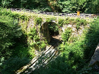
Bridge over the Breggia in Ticino |
||
The Breggia is about 23 km long river in the Italian province of Como in the Region of Lombardy and in the District Mendrisio in the Swiss canton of Ticino .
course
The Breggia rises between Monte Generoso and Monte d'Orimento above Erbonne directly on the Swiss border. It runs primarily in a south-westerly direction through the Val Breggia and after about 3 kilometers forms the border with Switzerland. From here it forms the border for about a kilometer before it finally crosses into Swiss territory at the confluence of the Vallaccia brook .
It now flows through the wooded Muggio Valley and, after Muggio, takes the Luasca stream from the Val Luasca from the left . After its confluence, the Breggia forms the municipal boundary between Breggia and Castel San Pietro and flows past the hamlets of Cabbio , Bruzella and Caneggio in the municipality of Breggia. At Bruzella it takes up the Breggia from the Val della Crotta , a stream of the same name, which also rises in Italy. On the municipal boundary of Castel San Pietro and Morbio Inferiore , it enters a deep gorge in the Po Valley . Here you can find countless fossils as well as numerous other traces of the primeval seas. After 1.5 kilometers the gorge opens again at Balerna .
It now forms the border between Chiasso and Morbio Inferiore and takes on the Faloppia from the right , only to cross the border to Italy a little later. It now flows through Como and Canobbio for the last 3 kilometers and finally flows into the southern part of Lake Como . It drains an area of around 90 square kilometers.
Individual evidence
- ↑ a b c Geoserver of the Swiss Federal Administration ( information )
- ↑ Hydrological Atlas of Switzerland of the Federal Office for the Environment FOEN, Table_13
- ↑ Breggia Gorge at myswitzerland.com.
Web links
- Breggia (river) in elexikon.ch


