
Breitungen (southern Harz)
|
Spreads
South Harz municipality
Coordinates: 51 ° 30 ′ 0 ″ N , 11 ° 3 ′ 0 ″ E
|
|
|---|---|
| Height : | 266 m above sea level NHN |
| Area : | 11.52 km² |
| Residents : | 470 (December 31, 2008) |
| Population density : | 41 inhabitants / km² |
| Incorporation : | January 1, 2010 |
| Postal code : | 06536 |
| Area code : | 034651 |
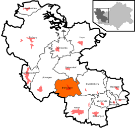  Location of Breitungen in the southern Harz
|
|
 View from the karst hiking trail to Breitungen
|
|
Breitungen is a district of the municipality of Südharz in the district of Mansfeld-Südharz in Saxony-Anhalt .
Geographical location
Breitungen is located in the southern Harz on the spur road that branches off the Roßla - Hayn road southwest of Agnesdorf . Not far from Breitungen is the Bauerngraben , an episodic lake in the southern Harz gypsum karst landscape .
history
Breitungen was first mentioned as Breydinge on July 29, 961 , when King Otto II gave this place to the Moritz monastery in Magdeburg .
Breitungen belonged to the rule of the Counts of Stolberg and was a village in the Office Roßla of the County of Stolberg-Roßla .
In 1819, 665 people lived in 115 houses in Breitungen.
From 1952 to 1990 Breitungen belonged to the GDR district of Halle .
2006 big celebration for the 1045th anniversary.
On January 1, 2010 the communities Breitungen, Bennungen , Breitenstein , Dietersdorf , Drebsdorf , Hainrode , Hayn (Harz) , Kleinleinungen , Questenberg , Roßla , Rottleberode , Schwenda and Uftrungen merged to form the new community Südharz. At the same time the administrative community Roßla-Südharz , to which Breitungen belonged, was dissolved.
church
source
Reg. Thur. No. 414, p. 94.
Web links
Individual evidence
- ↑ RI II No. 306
- ↑ StBA: Area changes from January 01 to December 31, 2010