
Drebsdorf
|
Drebsdorf
South Harz municipality
Coordinates: 51 ° 28 ′ 58 " N , 11 ° 10 ′ 32" E
|
|
|---|---|
| Height : | 191 m above sea level NHN |
| Area : | 4.29 km² |
| Residents : | 106 (Dec 31, 2008) |
| Population density : | 25 inhabitants / km² |
| Incorporation : | January 1, 2010 |
| Postal code : | 06536 |
| Area code : | 034656 |
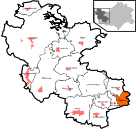  Location of Drebsdorf in the southern Harz
|
|
 View of Drebsdorf from the southwest
|
|
,_Pfarrhaus_und_Kirchturm.jpg)
Drebsdorf is a district of the municipality of Südharz in the district of Mansfeld-Südharz in Saxony-Anhalt .
Geographical location
Drebsdorf is located in the southern Harz on the country road between small lines and large lines on the Leine .
history
Drebsdorf belonged to the rule of the Counts of Stolberg and was a village in the Office Questenberg of the County of Stolberg-Roßla .
In 1819 Drebsdorf had 1865 residents in 43 houses.
From 1952 to 1990 Drebsdorf belonged to East Germany - Halle Region .
On January 1, 1970, the place was incorporated into the community of Kleinleinungen. Together with small lines, Drebsdorf came to large lines on April 1, 1974. Both Drebsdorf and Kleinleinungen became independent communities again when they were separated from Großleinungen on April 1, 1990.
On January 1st, 2010 the communities Drebsdorf, Bennungen , Breitenstein , Breitungen , Dietersdorf , Hainrode , Hayn (Harz) , Kleinleinungen , Questenberg, Roßla , Rottleberode , Schwenda and Uftrungen merged to form the new community Südharz. At the same time the administrative community Roßla-Südharz , to which Drebsdorf belonged, was dissolved.
church
Web links
Individual evidence
- ↑ Municipalities 1994 and their changes since January 1, 1948 in the new federal states , Metzler-Poeschel publishing house, Stuttgart, 1995, ISBN 3-8246-0321-7 , publisher: Federal Statistical Office
- ↑ StBA: Area changes from January 01 to December 31, 2010