Bremhof
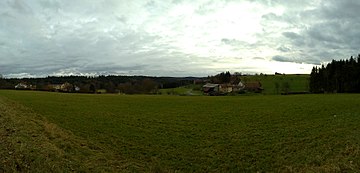
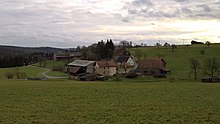
Bremhof is a hamlet in the Vielbrunn district of the city of Michelstadt in the Odenwaldkreis in Hesse . The hamlet consists of 14 inhabited houses, a restaurant and two farms.
Geographical location
Bremhof is located in the north of the cleared island in the Vielbrunn district in the headwaters of the Ohrbach stream . Bremhof and the hamlet of Brunnthal beyond the nearby forest belt on the municipal and state border are the settlements furthest north and east in the Michelstädter urban area. About two and a half kilometers northwest of the hamlet of Bremhof is the former Hainhaus ammunition depot and less than two kilometers to the west was the Hainhaus fort , a numerus fort on the older Odenwald line of the Neckar-Odenwald-Limes .
The state border between Hesse and Bavaria runs just a few kilometers east of the hamlet . The district road 94, which leads past the hamlet, continues eastwards to the Main to Laudenbach in Lower Franconia in the Miltenberg district .
history
To the north of the hamlet between Bremhof and Haingrund there is a burial mound , which may already date from the time of the Cord Ceramics and thus suggests the first settlements in the area during the Neolithic period . During the Roman times of the older Odenwald line , the later clearing island was east of the Limes, and with the relocation of the Limes to the Main about 50 years later, it came under Roman rule.
Today's hamlet Bremhof was mentioned as early as 1012 under the name "Brambuch". This derives from the brook Branbach , which represents an old border of the Odenwälder Bannforstes . The Cistercian Abbey of Bronnbach turned the hamlet of Brambuch (Bremhof) into a monastery courtyard ( Grangie ), which was later abandoned. In 1755 the estate was run by a Sebastian Herbert, after whom the Bremhof was also named Baschtelshof , whereby Baschtel is seen as a modification of Sebastian.
Interestingly, in 1787 the settlement was administratively divided into two parts: one part belonged to the county of Erbach-Schönberg , rule Breuberg , the other half to the principality of Löwenstein-Wertheim-Rochefort in the Cent Lützelbach. In 1806 the hamlet came to the Grand Duchy of Hesse .
Transport and infrastructure
Several buildings are listed in the hamlet :
- A house in a large courtyard has the year 1789 carved on the cellar. This includes stables, a wagon hall with storage and a sheep barn . To the north-east of the large courtyard are the remains of what was once a much longer row of positioning stones and a sandstone fountain in a large rectangular main tub with a profiled border and a cattle trough.
- The former hunting lodge with bakery and stables from the mid-19th century has been restored and is located above the large courtyard.
- On the path in a north-easterly direction there is a running well with a sandstone tub from the 19th century, the pier stock is possibly younger and has a pyramid-shaped crown in addition to a round arch ornament.
Bremhof is connected to the community of Vielbrunn to the south and to Lützelbach to the north via the K94 district road and the 3349 state road . There is a dining and snack bar for contemplation.
On the way between Bremhof and Geyersmühle is the Vielbrunn waterworks , built in 1905 and shut down in 1969, in the area of the former Hangenmühle . The historical waterworks, built in the Art Nouveau style with a pompous portico, has a fully preserved Pelton wheel pump inside.
Individual evidence
- ↑ Gastronomy-Vielbrunn. Retrieved January 18, 2018 .
- ↑ a b c Bremhof, Odenwaldkreis. Historical local lexicon for Hesse (as of November 8, 2017). In: Landesgeschichtliches Informationssystem Hessen (LAGIS). Hessian State Office for Historical Cultural Studies (HLGL), accessed on November 21, 2017 .
- ^ History of Vielbrunn , website of the community of Vielbrunn, accessed on January 4, 2017
- ↑ a b Sights. Website of the community of Vielbrunn, accessed on November 21, 2017.
Web links
- Bremhof, Odenwaldkreis. Historical local dictionary for Hessen. (As of November 8, 2017). In: Landesgeschichtliches Informationssystem Hessen (LAGIS).
Coordinates: 49 ° 44 ' N , 9 ° 7' E


