Bryn Mawr, Pennsylvania
| Bryn Mawr | ||
|---|---|---|
 Pembroke Hall on the Bryn Mawr College campus |
||
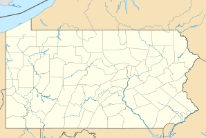
| Location in Pennsylvania | ||
|
|
||
| Basic data | ||
| Foundation : | 1869 | |
| State : | United States | |
| State : | Pennsylvania | |
| County : | Montgomery County | |
| Coordinates : | 40 ° 1 ′ N , 75 ° 19 ′ W | |
| Time zone : | Eastern ( UTC − 5 / −4 ) | |
| Residents : | 3,779 (as of 2010) | |
| Population density : | 2,361.9 inhabitants per km 2 | |
| Area : | 1.6 km 2 (approx. 1 mi 2 ) of which 1.6 km 2 (approx. 1 mi 2 ) are land |
|
| Height : | 128 m | |
| Postal code : | 19010 | |
| Area code : | +1 610 | |
| FIPS : | 42-09728 | |
| GNIS ID : | 1170487 | |
Bryn Mawr ( [bɾɪn maueɾ] , from Welsh for "big hill") is a census-designated place (CDP) in Montgomery County , west of Philadelphia on Lancaster Avenue (US-30) and the border with Delaware County in the US State of Pennsylvania . Bryn Mawr sits in the middle of what is known as the Main Line , a group of quaint and affluent Philadelphia suburbs that stretch from the Philadelphia city limits to Malvern . According to the 2010 census , the place had 3779 inhabitants. Bryn Mawr is known for Bryn Mawr College .
history
Bryn Mawr means big hill in Welsh . The name goes back to an estate near Dolgellau in North Wales, which was the farm of the Quaker Rowland Ellis, who was religiously persecuted in 1686 and emigrated to Pennsylvania.
Originally the city was called Humphreysville. In 1869, the city was renamed by railroad agent William H. Wilson after he had acquired the 1.15 km 2 city for the Pennsylvania Railroad .
geography
According to the United States Census Bureau , the place has a land area of 1.6 km 2 . However, Bryn Mawr's zip code (19010) covers a larger area and consequently the geographical name Bryn Mawr is used more often.
Demographic data
According to the 2000 census, there were 4,382 people in 1,404 households and 525 families in Bryn Mawr. The population density was 2728.9 per km 2 . The village consisted of 1481 housing units with an average density of 922.3 per km 2 .
In the 1,404 households there were children under the age of 18 in 13.5% of cases, 26.8% were married couples , 8.9% were single mothers and 62.6% were non-families. 41.1% were single-person households, in 13.7% of the cases these persons were 65 years of age or older. The average household size was 2.07 and the average family size was 2.79 people.
About 8.4% of the population was younger than 18 years old, 48.1% were 18 to 24 years old, 21.0% were 25 to 44 years old, 12.1% were 45 to 64 years old, and 10.5% were 65 years old or older. The median age was 22 years. For every 100 women there were 46.5 men. For every 100 women aged 18 and over there were 42.4 men.
Known residents
- Eric George Adelberger (* 1938), experimental nuclear physicist and gravitational physicist
- James Hadley Billington (1929–2018), Director of the Library of Congress
- John Bogle (1929–2019), founder and former CEO of The Vanguard Group
- Neal Boortz (* 1945), author and radio host
- Fran Crippen (1984-2010), swimmer
- Kat Dennings (* 1986), actress
- Drew Gilpin Faust (* 1947), American Civil War historian and first female president of Harvard University , graduated from Bryn Mawr College
- Hanna Holborn Gray (* 1930), historian of German history and the first female president of the University of Chicago , graduated from Bryn Mawr College
- Edith Hamilton (1867–1963), classical philologist, graduated and taught at Bryn Mawr College
- Katharine Hepburn (1907–2003), actress and four-time Oscar winner, graduated from Bryn Mawr College
- Elizabeth Hoffman (* 1946), economist
- Jed Levy (* 1958), jazz musician
- Jayne Mansfield (1933-1967), actress
- Jacqueline Mars (* 1940), heiress to Mars Incorporated
- Agnes Nixon (1922-2016), creator of All My Children and One Life to Live
- Emmy Noether (1882–1935), German mathematician
- Teddy Pendergrass (1950-2010), singer
- Richard Swett (born 1957), Congressman
- Emlen Tunnell (1925–1975), NFL player for the New York Giants and Green Bay Packers , member of the Pro Football Hall of Fame
- Woodrow Wilson (1856–1924), 28th President of the United States, taught political science at Bryn Mawr College before going to Princeton University and later becoming governor of New Jersey
- Janny Wurts (* 1953), fantasy author and illustrator
- Warren Zevon (1947-2003), musician
Individual evidence
- ^ The Quakers of Dolgellau. In: BBC.co.uk
- ^ Snowdonia National Park Authority. (No longer available online.) Archived from the original on September 28, 2007 ; Retrieved April 18, 2007 . Info: The archive link was inserted automatically and has not yet been checked. Please check the original and archive link according to the instructions and then remove this notice.
- ^ Bryn Mawr CDP, Pennsylvania (map). (No longer available online.) Formerly in the original ; Retrieved April 18, 2007 . ( Page no longer available , search in web archives ) Info: The link was automatically marked as defective. Please check the link according to the instructions and then remove this notice.
- ^ Henry Wilkinson Bragdon: Woodrow Wilson: The Academic Years. Belknap Press, Cambridge 1960.
