Byeonsanbando National Park
| Byeonsanbando ( 변산 반도 국립 공원 ) | ||
|---|---|---|
|
|
||
| Location: | Jeollabuk-do , South Korea | |
| Next city: | County Buan-gun ( 부안군 ) Jeongeup ( 정읍시 ) County Gochang-gun ( 고창군 ) | |
| Surface: | 154.644 km 2 | |
| Length: | 22nd | |
| Founding: | June 11, 1988 | |
| Visitors: | 1,500,000 (2016) | |
The Byeonsanbando National Park ( Korean 변산 반도 국립 공원 ) is one of 22 National Park in South Korea . It was established in 1988 as the 19th national park on the west coast of the country.
geography
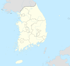
Byeonsanbando National Park is located around 50 km southwest of Jeonju ( 전주시 ) in Buan-gun County ( 부안군 ) in Jeollabuk-do Province ( 전라북도 ). The 154.644 km 2 national park has a length of around 22 km in its southwest-northeast extension and measures around 11 km at its widest point. The park is divided into two sections, the Oebyeonsan ( 외변산 ) part, which includes the northwest coast, and the inland part, which is known as Naebyeonsan ( 내변산 ), which includes the mountainous landscape.
The highest mountain in the national park is the Gisangbong ( 기 상봉 ), which has a height of 509 m . To the southwest, the mountain peaks with the Gamnamsan ( 갑 남산 ) flatten to up to 409 m . In the north-western part of the mountains of the national park there is the Buan reservoir ( 부안 호 ), which meanders through the valleys of the mountains for around 7 km, similar to the shape of a Chinese dragon. At the northern end of the reservoir there is a hydroelectric power station for generating electricity. Seven other smaller reservoirs are used to supply drinking water and supply water to agriculture in the interior outside the national park.
geology
The mountain formations of the national park are of volcanic origin and consist of rhyolite , which was formed in the Cretaceous period . The layers of deposits of volcanic origin can be seen particularly well on the Chaeseokgang cliffs ( 부안 채석강 ), which rise out of the sea on the coast at the eastern end of the national park.
history
Byeonsanbando was designated as a provincial park on December 2, 1971 by the government of Jeollabuk-do Province. On June 11, 1988, it was upgraded to a national park by the Ministry of Land, Transport and Maritime Affairs. On August 30, 2003 the area of the park was corrected from 155.924 km 2 to 154.715 km 2 and on December 7, 2006 it was corrected again to 154.664 km 2 . On October 5th, the national park office was renamed to its current name Byeonsanbando National Park Office .
Flora and fauna
In the national park, which is visited by around 1.5 million tourists every year, 877 different plant species and 996 different animal species were encountered. The Chinese holly that occurs in the park , the Ilex crenata, also a species of holly, the silver magnolias and the Abeliophyllum distichum are protected in South Korea.
literature
- 전국 안내 지도 . 우성 지도, Seoul 1999,ISBN 89-85762-10-9(National Guide Map).
Web links
- Introduction . Korea National Park Service,accessed November 25, 2017.
- Byeonsanbando National Park: green mountains, blue seas, and golden sunsets . In: Korea.net . Global Communication and Contents Division,accessed November 25, 2017.
Individual evidence
- ↑ a b 전국 안내 지도 . 우성 지도 , Seoul 1999, ISBN 89-85762-10-9 , pp. 15 ( National Guide Map ).
- ↑ a b Coordinates and longitudes were partly made using Google Earth Pro Version 7.3.0.3832 on November 25, 2017.
- ↑ Byeonsanbando National Park ( 변산 반도 국립 공원 ). In: Visit Korea . Korea Tourist Organization , accessed November 25, 2017 .
- ↑ 부안댐 물 문화관 . In: Visit Korea . Korea Tourist Organization , accessed November 25, 2017 (Korean).
- ↑ a b Introduction . Korea National Park Service , accessed November 25, 2017 .
- ↑ Chaeseokgang Cliffs ( 부안 채석강 ). In: Visit Korea . Korea Tourist Organization , accessed November 25, 2017 .
- ^ History . Korea National Park Service , accessed November 25, 2017 .
