Songnisan National Park
| Songnisan ( 속리산 국립 공원 ) | ||
|---|---|---|
| Gwaneum in Songnisan National Park | ||
|
|
||
| Location: | Chungcheongbuk-do , South Korea | |
| Surface: | 274,541 km 2 | |
| Founding: | March 24, 1970 | |
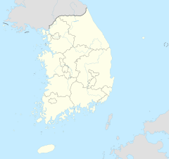
The Songnisan National Park ( Korean 속리산 국립 공원 ) is one of 22 National Park in South Korea . It was established in 1970 as the sixth national park in the middle of the country.
Origin of name
Legend has it that Songnisan means "mountains to leave the world". The mountains got their name when a monk came to the temple of Beopjusa ( 법주사 ) in the 5th year of Queen Seondeok's reign ( 선덕여 왕 ) from Silla ( 신라 ) and oxen kneeled down in front of him on his way. When the farmers saw this, they followed the monk to practice Buddhism .
geography
Songnisan National Park is located around 40 km northeast of Daejeon ( 대전 광역시 ), around 35 km southwest of Cheongju ( 청주시 ) and around 33 km west-southwest of Mungyeon ( 문경시 ), partly in the province of Chungcheongbuk-do ( 충청북도 ) and Gyeongsangbuk -do ( 경상북도 ).
In the National Park, the reservoir Samgajeosuji (located 삼가 저수지 ) propagating from the dam to North East and Eastern and lengths of 1.66 km and 1.83 km has. Its maximum width is around 420 m. The reservoir, which is not used to generate electricity, has four outflows, distributed over three directions. About 5.5 km to the north is the highest mountain in the national march, the Cheonwangbong ( 천왕봉 ), at 1058 m , around which the national park extends and eight mountain peaks span in an arc.
history
On June 24, 1964, Songnisan was listed as a place of historical and scenic value under registration number 4 by the Ministry of Culture, Sports and Tourism. Almost five years later, the Ministry of Land, Transport and Maritime Affairs decided to designate the area for tourism and another later, on March 24, 1970, it was designated a national park. On December 30, 1984, the area of the national park was expanded from 106.18 km 2 to 283.4 km 2 and renamed Songnisan National Park on October 5, 2017. When exactly the change in area to 274.541 km 2 is not known.
Flora and fauna
A special feature of the national park is the Siberian flying squirrel (Pteromys volans), which can move from tree to tree while gliding. It is considered an endangered species in South Korea.
literature
- 전국 안내 지도 . 우성 지도, Seoul 1999,ISBN 89-85762-10-9(National Guide Map).
Web links
- Introduction . Korea National Park Service,accessed November 25, 2017.
Individual evidence
- ↑ Legend . Korea National Park Service , accessed November 25, 2017 .
- ↑ a b 전국 안내 지도 . 우성 지도 , Seoul 1999, ISBN 89-85762-10-9 , pp. 13 ( National Guide Map ).
- ↑ Coordinates and longitudes were partly made using Google Earth Pro Version 7.3.0.3832 on November 25, 2017.
- ↑ Introduction . Korea National Park Service , accessed November 25, 2017 .
- ^ History . Korea National Park Service , accessed November 25, 2017 .
- ↑ Flagship Species . Korea National Park Service , accessed November 25, 2017 .

