Gyeryongsan National Park
| Gyeryongsan National Park | ||
|---|---|---|
|
|
||
| Location: | Chungcheongnam-do , South Korea | |
| Next city: | Muju | |
| Surface: | 231.65 km² | |
| Founding: | 1st February 1968 | |
| Address: | Gyeryongsan National Park Office, Address: 777, Hakbong-ri, Banpo-myeon, Gongju Si, Chungcheongnam-Do | |
| Ranger station in Gyeryongsan | ||
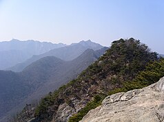
| The Gyeryong as seen from Jang-gun | ||
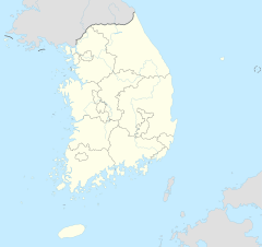
The Gyeryongsan National Park ( 계룡산 국립 공원 ) is, together with the Gyeongju National Park , the second national park that was established in South Korea . It is located a few kilometers west of the city of Daejeon in Chungcheongnam-do Province .
Location and geography
The park is located a few kilometers west of the city of Daejeon . The highest point is the 845 meter high Gyeryongsan. The park is also known for its waterfalls.
Flora and fauna
There are 1121 plant species in the national park, 1867 of 2512 animal species are insects, the remaining animal species include animals such as martens , otters , black woodpeckers and buzzards .
Attractions
Sights include Gapsa, Donghaksa, and Sinwonsa temples. The Gapsa Temple was founded in the year 420 in the Baekje period . During the Imjin War , monk warriors were also recruited and trained here. Architecturally, the temple differs through the lecture hall, which is just not part of such a facility. The Donghaksa is the oldest of the academic institutions for the training of Buddhist nuns. In spring, the Donghaksa Spring Flower Festival takes place here.
Web links
- Park page on the Korea National Park Service website
- Gapsa Temple website (Korean)
- Donghaksa Temple website (Korean)
Individual evidence
- ↑ a b Gyeryongsan National Park . Korea National Park Service.
- ↑ http://german.visitkorea.or.kr/ger/SI/SI_GE_3_1_1_2.jsp?cid=335411
- ↑ The Donghaksa Temple
- ↑ The Donghaksa Temple


