Cirencester
Coordinates: 51 ° 43 ′ N , 1 ° 58 ′ W
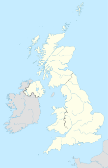
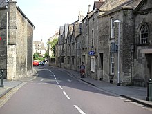
Cirencester [ ˈsaɪərənsɛstər ] is a town of about 19,000 people in Gloucestershire , England , 150 km north-west of London . Located on the Churn , a tributary of the Thames , it is the largest town in the Cotswolds . The city has a small but thriving commercial sector. It has numerous historical buildings. New buildings are carried out according to the strictest guidelines so as not to destroy the uniform image of the city. Cirencester is home to the famous Royal Agricultural College , the oldest college for agriculture in the English-speaking world, built in 1840. The city's Corinium Museum is known for its extensive Roman collection.
geography
Cirencester is in the hills of the Cotswolds. The natural drainage goes into the churn, which flows roughly from north to south through the eastern part of the city and meets the Thames again at Cricklade . The Thames itself flows a few miles west of Cirencester. The city is divided into five areas: The town center, the suburbs of Chesterton, Stratton, Watermoor (villages outside the city), and the Beeches Estate (an area of houses dating from 1950). The village of Siddington in the southwest of the city is part of Watermoor. The city is the focal point for the surrounding area because of jobs, the pleasant location, shops, trade and education. Also worth mentioning is the village of Bibury , known for its beautiful old houses.
traffic
Cirencester is the hub of a major road network with major roads to Gloucester ( A417 ), Cheltenham ( A435 ), Warwick ( A429 ), Oxford ( A40 via the B4425 ), Wantage (A417), Swindon ( A419 ), Chippenham (A429), Bristol and Bath ( A433 ), and Stroud (A419).
These good transport routes allow the city's trade to flourish. Despite its location, the city center is free from much traffic. This is ensured by a ring road and the bypass road; Both streets have plenty of good parking facilities. The city also has a train station, Kemble railway station, with trains to London ( Paddington ), about six kilometers from the city. The nearest airports are in Bristol , Cardiff and Birmingham , all at least an hour away by car.
history
The Roman Corinium
The Romans built a military camp at the point where the Fosse Way crosses the Churn River as a strategic base to defend the local borders c. AD 49, against the Dobunni who were evicted from the village of Bagendon . When the border moved further north to conquer Wales , the fort was closed. Nevertheless, the city that was created there continued to exist under the name Corinium Dobunnorum.
During the Roman period, the wool trade and industry flourished, which helped Corinium grow rapidly. A large forum and basilica were built and archaeological evidence attests to the civil prosperity. When a defensive wall was built around the city in the second century, Corinium was already the second largest city in Britain . It became the seat of the province of Britannia prima in the fourth century.
The amphitheater still exists in the Querns in the southwest of the city, but has not been fully excavated. Research in the city revealed that it was built in the fifth or sixth century. It is also possible that there a British king defeated his opponent Ceawlin in 577. Later the square was again a scenario of the war between the King Penda of Mercia and the West Saxon kings Cynegils and Cwichelm in 628.
Roman remains and relics can be found all over the area, such as some Roman villas at Chedworth and Withington .
middle Ages
The Minster Church , built in the 9th or 10th century, was believed to have been a royal foundation. The monastery was given to the Augustinian Canons in the twelfth century . The previous collegiate church was replaced by the Great Abbey Church .
The Normans
During the Norman Conquest, the royal estate of Cirencester belonged to William FitzOsbern, 1st Earl of Hereford , and in 1075 it reverted to the Crown. The estate now belonged to Cirencester Abbey , built by Henry I in 1117, which were completed in 1167.
Tudor Cirencester
During the destruction of the monasteries in 1539, Henry VIII ordered the total demolition of the abbey. Today only the Norman arches and parts of the district wall that form the boundary of the public park in the center of the city remain.
Sheep-raising , wool distribution , weaving and clothing- making were the main strengths of England in the Middle Ages, and not only the clergy, but also Cirencester's traders and tailors , grew in wealth and prosperity in the national and international markets. The graves of these traders can be viewed in the parish church, while the fine old houses on Coxwell and Dollar Streets are still inhabited. They invested their wealth in the new building of the nave of the parish church in 1515-30. The parish church is now often referred to as the "Cathedral of the Cotswolds". Other churches of this type are in neighboring Northleach and Chipping Campden .
During the civil war
The English Civil War hit Cirencester in February 1643 when royal horsemen and parliamentarians fought in the streets. Over 300 people died and 1200 prisoners were held in the church. The citizens of the city support the parliamentarians, the nobility and clergy were in favor of the conservative old order.
Recent history
By the late 18th century, Cirencester was a thriving market town as the center of a toll road system with easy access to markets and productions of grain and wool. A grammar school provided education for anyone who could afford it, and businesses and businesses thrived.
When the Thames and Servers Canal opened in 1789 , Cirencester gained access to more distant markets. In 1841 a train line to Kemble was opened to provide a line to Swindon . The Midland and South Western Junction Railway opened a station in Watermoor in 1883. So Cirencester had two train lines before the 1960s.
The loss of the canal and the train line as a transport route increased the dependence on road traffic. A ring road system was completed in 1975. In order to avoid traffic jams in the city center, a bypass road, the A417, was built.
In 1894, the Urban District Council was elected for the first time in Cirencester. The reorganization of the local government replaced the Urban District Council in 1974 and the two-tier Cotswold District Council System and Cirencester Town Council still govern there today .
The name of the city
The name Corin is related to Churn (the modern name of the river on which Cirencester was built) and included with Cerne in the names of the nearby villages of North Cerney , South Cerney , and Cerney Wick . The modern name 'Cirencester' is derived from the related Ciren and the standard -cester ending, indicating Roman fortresses. It looks like the roots of this name go back to before Roman times and it is similar to the river's original Brythonic name. An early ecclesiastical list from the Church of St David's in Wales gives another form of the name Caerceri . Here, Caer is the Welsh form for Roman forts and Ceri is related to another form of the name.
In Saxon times, the name of the city was written as Cirrenceastre or Cyrneceastre . The form Ciceter invented by William Shakespeare was previously used as an abbreviation. Sometimes the form Cicester is used as a substitute. The abbreviation Ciren is common today .
Leisure and entertainment
Cirencester has an important tourism market, shopping, entertainment, and sports facilities for residents of the city and the surrounding area.
Interesting facts
The parish church of St John the Baptist , often referred to as the 'Cathedral of the Cotswolds', has a nave from 1515–1530, a large tower and a considerable south porch. A fine example of a wool church , amid its many chapels, is St. Catherine with its beautiful stone tracery roof from 1508. The Roman amphitheater can be found on Cotswold Avenue.
Sports
In April 2006 the Cotswold Leisure Center moved into its new premises. The center is owned by the Cotswold District Council . It contains a swimming pool, a sauna, a steam bath, showers, a relaxation area, a large sports hall, a gym and a fitness center. The city also has an outdoor swimming pool that is run by volunteers and is only open in the summer months.
The football club Cirencester Town FC , plays in the Southern League Premier Division . Known as The Centurions , the team moved from their first sports field to Corinium Stadium . The club is run by the Football Association as a community club. Every week the association offers training and games for 300 children from six to 18 years of age. The city has another soccer team, Cirencester United FC, which play in the Hellenic Football League .
At the airport, Aston Down (10 km west of Cirencester) can at Cotswold Gliding Club gliding .
Town twinning
Cirencester has had a partnership with the city of Itzehoe , Schleswig-Holstein , since 1982 .
Personalities
- Cozy Powell , drummer (1947-1998)


