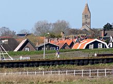
The oever
| province |
|
| local community |
|
|
Area - land - water |
1.11 km 2 1.11 km 2 0 km 2 |
| Residents | 2,135 (Jan 1, 2017) |
| Coordinates | 52 ° 56 ' N , 5 ° 2' E |
| Important traffic route |
|
| prefix | 0227 |
| Postcodes | 1777, 1779 |
Den Oever is a small village 18 km east of Den Helder directly at the southwest end of the closure dike in the municipality of Hollands Kroon on the former island of Wieringen in the northeast of the province of North Holland and is home to around 2,135 people (as of January 1, 2017).
history
The place name "den Oever" means "the bank" and is an old name for the area in which the village is located. When the Dutch Wadden Sea was formed, the area was open water only to the east. When the Wadden Sea and Zuiderzee expanded, there was half mud flats, half open water. The bank was further west about near Oosterland . But in the 14th and 15th centuries the shore of the island of Wieringen pushed forward again and several small settlements were founded, one of which was Den Oever.
Due to the growth of the village and port in the 20th century, the older neighboring settlement of Oud-Gest became part of De Oever. At the end of the century it also grew together with De Gest.
Den Oever chapel and inn were built side by side. The ensemble is now in the Zuiderzee Museum in Enkhuizen .
The former island Wieringen was in 1929 when the dikes gained polder Wieringermeer (Wieringer Lake, former sea area south of the former island to the municipality of Medemblik ) its name. The difference between “old” and “new” land can be clearly seen in the area. With good visibility you can see the wadden island Texel from there .
Infrastructure
The Stevinsluizen tide barrier , named after the engineer and mathematician Simon Stevin , was built at the western end of the final dike in Den Oever . It comprises three five-part sewage systems and a lock .
Attractions
- Harbor with large fish halls
- Windmill "De Hoop": The 1960 restored flour mill is a small octagonal Erdholländer with a cladding Reet . It was probably built in Huisduinen in 1672 , although a beam bears the date 1654. She was transferred to Den Oever in 1845.
- "Vikinginformatiecentrum" (VIC) since 2004, previously House of the Earth ( Het Huis van de Aarde ), presents the legacies of the Vikings from the early Middle Ages in Wieringen.
- some old farms.
Web links
- Description of the mill on the website molendatabase.nl (including Dutch, German, English)
- Description of the marina Den Oever with pictures on the website fahrtensegeln.de (German)
Individual evidence
- ↑ a b Kerncijfers wijken en buurten 2017 Centraal Bureau voor de Statistiek , accessed on May 12, 2018 (Dutch)
