Carmen Alto District
| Carmen Alto District | |
|---|---|
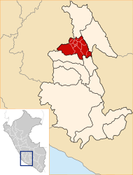
 The Carmen Alto district is centrally located in the Huamanga Province (marked in red) |
|
| Basic data | |
| Country | Peru |
| region | Ayacucho |
| province | Huamanga |
| Seat | Carmen Alto |
| surface | 22.4 km² |
| Residents | 29,459 (2017) |
| density | 1315 inhabitants per km² |
| founding | September 6, 1920 |
| ISO 3166-2 | PE-AYA |
| Website | municarmenalto.gob.pe (Spanish) |
| politics | |
| Alcalde District | Jesús Luis Llallahui León (2019-2022) |
| Political party | Movimiento Regional Gana Ayacucho |
| Mirador del Cerro Acuchimay | |
Coordinates: 13 ° 10 ′ 33 ″ S , 74 ° 13 ′ 36 ″ W
The Carmen Alto district is located in the Huamanga Province in the Ayacucho region in south-central Peru . The district was founded on September 6, 1920. The district has an area of 22.4 km². The 2017 census counted 29,459 inhabitants. In 1993 the population was 8914. The district administration is located in the 2800 m high town of Carmen Alto with 25,181 inhabitants (as of 2017). Carmen Alto is located in the southwest of the metropolitan area of the provincial and regional capital Ayacucho (Huamanga).
Geographical location
The Carmen Alto district is centrally located in the Andean highlands in the Huamanga province. The district is part of the greater Ayacucho area. It lies between the Río Alameda in the west and the Río Chaqui Huayco in the east. In the far north lies the viewpoint Mirador del Cerro Acuchimay on a hill.
The Carmen Alto district borders on the Socos district in the west, the Ayacucho district in the northwest, the San Juan Bautista district in the northeast and east and the Chiara district in the south .
Web links
- Municipaliad Distrital de Carmen Alto
- Peru: Ayacucho region (provinces and districts) at www.citypopulation.de
- INEI Perú
