Duckterath
|
Duckterath
City of Bergisch Gladbach
Coordinates: 50 ° 59 ′ 5 ″ N , 7 ° 6 ′ 13 ″ E
|
||
|---|---|---|
|
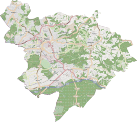
Location of Duckterath in Bergisch Gladbach |
||
|
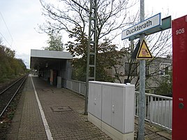
Duckterath stop on S-Bahn 11
|
||
Duckterath is a district in the Gronau district and in the Hand district of Bergisch Gladbach .
history
The Duckterath settlement emerged from an early medieval court establishment, which can probably be documented as "Dudenrothe" as early as 922 . The basic word "rath / roth" (from Middle High German ruiten = clearing, to make arable) refers to the layout of the settlement. The settlement recorded in the Rhenish-Westphalian original cadastre as Dükteroth was about 150 meters south of the road from Mülheim to Gladbach (today: Mülheimer Straße ). Most recently the so-called Miebachshof stood there at the eastern end of today's Schluchterheide street . It was demolished in the 1960s. This settlement emerged from an early medieval court establishment, which can be documented as Dudenrothe . The basic word rath / roth refers to clearing .
In the vicinity, the streets Duckterather Weg (1916) and Duckterather Busch (1959) were named after this settlement .
Mining
In the vicinity of Duckterath, mining was carried out on the Hohenzollern mine in the 19th century , which still shows its traces through old pings . On the corresponding award plan , the place bears the name Dükteroth - as in the original cadastre .
Duckterath station
Duckterath is also the name of the stop on the Cologne-Mülheim-Lindlar railway in the Gronau district of Bergisch Gladbach. It is served by the S-Bahn line S 11 coming from Cologne or Neuss / Düsseldorf .
Web links
- Citizen portal Bergisch Gladbach, 100 more parking spaces at the P + R car park Duckterath, accessed on April 29, 2016
- Stop in Duckterath More space for commuters accessed on April 29, 2016
- NRWbahnarchiv by André Joost:
Individual evidence
- ^ A b c Andree Schulte, Bergisch Gladbach, City history in street names , Bergisch Gladbach 1995, p. 81 ISBN 3-9804448-0-5
- ^ Herbert Stahl (editor) and others: "Gronau", Bergisch Gladbach 2007, p. 112 ff. ISBN 978-3-932326-51-6

