
Bruchhof-Sanddorf
|
Bruchhof-Sanddorf
City of Homburg
Coordinates: 49 ° 20 ′ 35 " N , 7 ° 21 ′ 53" E
|
||
|---|---|---|
| Height : | 250 m above sea level NHN | |
| Residents : | 2983 (Jun. 1, 2020) | |
| Incorporation : | April 1, 1938 | |
| Postal code : | 66424 | |
| Area code : | 06841 | |
Location of Bruchhof-Sanddorf in Saarland |
||
 Karlsberger Hof in Sanddorf
|
||

Bruchhof-Sanddorf is a district of the Saar-Palatinate district town of Homburg in Saarland . It is made up of the two parts Bruchhof and Sanddorf , which are mentioned separately on the town signs , but merge into one another. The Eichelscheid, located outside, also belongs to Bruchhof .
Geographical location
Bruchhof and Sanddorf are northeast of Homburg at an altitude of approx. 250 m above sea level. NHN . According to the natural spatial structure , the lower layers - towards Königsbruch and Closenbruch - belong to the Homburg Basin , part of the St. Ingbert-Kaiserslauterer Senke . The higher altitudes - belonging to the forest - on the other hand, belong to the Sickinger step natural area , part of the Zweibrücker Westrich .
Residents
Bruchhof-Sanddorf has 2,983 inhabitants (as of June 1, 2020), of which 1,857 are in Bruchhof and 1,126 in Sanddorf.
Bruchhof

On the map by Tilemann Stella from 1564/1565 there is only one farm in the area of today's Bruchhof, the Naun-Hof . In 1760/70 the Bruchhof , later Königsbrucher Hof , then named after its penultimate owner Tascher Hof and today Gut Königsbruch , was built. This is located on the northeastern outskirts of Bruchhof and is a listed building. The manor house with its farm buildings is very similar to the Louisenhof, built in 1760 on the Buchenbergsoll, which was the nucleus of the Karlsberg Palace.
The Königsbruch , which gave the Königsbrucher Hof and thus ultimately Bruchhof its name, is part of the Landstuhler Bruch , an extensive moorland.
In 1811 there were only two small houses, called Steinthor , in addition to the Königsbrucher Hof . The day laborers, artisans and small farmers employed at the Königsbrucher and Karlsberger Hof gradually settled in the district, which is still known today as Schelmenkopf (named after the 258 meter high local mountain). This later became today's Bruchhof. The Mannheim – Saarbrücken railway runs through the town ; but there are no more stops.
Sand village
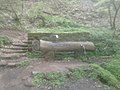
In the Sanddorfer Wald on the Karlsberg, formerly Buchenberg, are the ruins of the Karlsberg Castle . The only remaining building in the palace complex is the Karlsberger Hof in Sanddorf. It was built in 1776–85 as a construction warehouse for the castle and subsequently used as a storage and residential building, sugar refinery, brewery and forestry house. Finally it was bought by the Karlsberg Brewery in 1975 , renovated and then used as the director's villa.

The Karlsbergweiher in the Sanddorf Forest
The Karlsberg spring in the Sanddorf forest


Eichelscheid
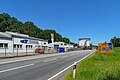
In Eichelscheid there was a train station from 1892 to 1959. This was used by the residents of Bechhofen , Lambsborn , Rosenkopf , Käshofen and Wiesbach , for whom Eichelscheid was the closest station. Attached to the station was a freight station where mainly fertilizers, seeds and agricultural machines were handled for the places mentioned, but above all for the Eichelscheiderhof .
From 1920 to 1935 and from 1945 to the end of 1956, the station was the railway border station between the then independent Saar area or Saarland and the Federal Republic of Germany . The Kaiserstrasse border crossing was also here. With the reintegration of Saarland in 1959, the breakpoint was closed.

View of Eichelscheid

View of Eichelscheid - view in south-west direction
View of Eichelscheid - view in northeast direction


Political Affiliation
After the Congress of Vienna, Bruchhof and Sanddorf belonged to the Landkommissariat Homburg in the Bavarian Rhine district from 1818 to 1862 (renamed " Kreis Pfalz " in 1837 ), from 1862 to 1920 to the district office of Homburg . As a result of the Versailles Treaty , Bruchhof and Sanddorf were spun off from the Homburg district office and remained with the German Empire when the Saar area was separated . On April 1, 1921, the localities Bruchhof and Sanddorf formed an independent municipality which, like Kirrberg, from then on belonged to the Zweibrücken District Office . After a referendum it was incorporated into the city of Homburg on April 1, 1938.
Camping site Königsbruch
The Königsbruch campsite is located in the Königsbruch between Eichelscheid and Eichelscheiderhof . With 250,000 m² of floor space and 500 parking spaces at four of its own quarry ponds , it is one of the largest campsites in Saarland.

Facilities
The primary school Bruchhof-Sanddorf, a day-care center and a branch of the city library are located in the village. The newly designed village square was inaugurated in May 2009. Somewhat out of the way in the forest on the Großer Kehrberg is the new Gustav-Köhler-Hütte (Kehrberghütte) of the Palatinate Forest Association, local group Homburg , which opened in 2012 . It replaces the old Kehrberghütte from 1956, which fell victim to an arson attack in 2010 .
Web links
- Bruchhof-Sanddorf private information page on the double location
- Literature on Bruchhof-Sanddorf in the Saarland Bibliography
- Picture gallery and history of Bruchhof on the website homburg-im-bild.de
Individual evidence
- ↑ a b Homburg: Data and facts, residents by district , accessed on July 6, 2020
- ^ Karlsberger Hof on the old website of the city of Homburg's website
- ↑ The local border - Eichelscheid (PDF; 1.4 MB) Poster for the exhibition Homburg was the border town of the city of Homburg
- ↑ Statistics of the German Reich, Volume 450: Official municipality directory for the German Reich, Part I, Berlin 1939; Page 269
- ^ Wilhelm Volkert (ed.): Handbook of Bavarian offices, communities and courts 1799–1980 . CH Beck, Munich 1983, ISBN 3-406-09669-7 , p. 600 .
- ↑ Saarbruecker-Zeitung.de: Holzlose for the new hut , accessed on September 12, 2019
