
Erlauf (river)
| Erlauf | ||
 Location of the Große Erlauf in the Eisenwurzen |
||
| Data | ||
| Water code | AT : 1272 | |
| location | Austria , Lower Austria | |
| River system | Danube | |
| Drain over | Danube → Black Sea | |
| source | South-western slope of the Gemeindealpe 47 ° 48 ′ 2 ″ N , 15 ° 14 ′ 6 ″ E |
|
| Source height | 935 m above sea level A. | |
| muzzle |
Danube near Pöchlarn Coordinates: 48 ° 12 '48 " N , 15 ° 11' 40" E 48 ° 12 '48 " N , 15 ° 11' 40" E |
|
| Mouth height | 214 m above sea level A. | |
| Height difference | 721 m | |
| Bottom slope | 10 ‰ | |
| length | 70 km | |
| Catchment area | 631.5 km² | |
| Left tributaries | Small Erlauf | |
| Right tributaries | Jessnitz | |
| Flowing lakes | Erlaufsee | |
| Reservoirs flowed through | Erlaufstausee | |
| Small towns | Scheibbs , Wieselburg | |
 Erlauf Gorge of the Große Erlauf near Purgstall |
||
The Erlauf is a tributary of the Danube in the Scheibbs and Melk districts in Lower Austria and partly in Styria . The Erlauf is about 70 km long and flows into the Danube at Pöchlarn .
etymology
In Roman times, the Arelape river , like the Roman fort with a naval base on the Danube, was now called the town of Pöchlarn and the civil settlement, which, after the original course of the river, was located at the former mouth, is now the market town of Erlauf . The current name arose from the earlier form of the name Erlaf .
geography
course

The Erlauf (also called the Große Erlauf on the upper reaches ) rises at the foot of the Gemeindealpe and is the inlet of the Erlaufsee . Thereafter, it flows over the Tormäuer by the natural park Oetscher-Tormäuer , on Oetscher past (here opens the Treffling stream immediately be located at the confluence Treffling case ), then via Kienberg gaming , Scheibbs , purgstall an der erlauf until after Wieselburg . This is where the Kleine Erlauf flows , which arises at Gresten ( 47 ° 55 ' N , 15 ° 3' E ) and continues via Randegg, Steinakirchen am Forst to the mouth in Wieselburg. The river then runs in a north-northeast direction and flows into the Danube at Pöchlarn .
nature
Almost 40% of the course of the river can still be described as near-natural. A fish migration is no longer possible due to several power plants. A small sensation was the discovery of the brook lamprey ( Lampetra planeri ) in the Große Erlauf around 1985, which was believed to be extinct here .
In the municipal area of Purgstall an der Erlauf, the river has dug itself deep into the gravel that has landed since the Ice Ages over the millennia. The resulting Erlaufschlucht (called “Prater”) has been a natural monument since 1972 due to its unique landscape features .
economy
On the "Große Erlauf", electrical energy is generated in several power plants. The first power plant in the Erlaufklause after the Erlaufsee is the Erlaufboden power plant , the oldest on the river. It is owned by EVN and supplies energy for the Mariazellerbahn . Further down the river in Scheibbs, Mühling bei Wieselburg, Wieselburg (E-Werk Fahrner - just behind the confluence of the large and small Erlauf) and in Erlauf there are further power plants.
literature
- Irene M. Weiß: Bridges and footbridges over the Great Erlauf . Erlauftaler Bildungskreis Association, Purgstall 2003, ISBN 3-900019-00-2
- Georg Holzer : The Slavs in the Erlaftal. A landscape of names in Lower Austria . Editors Anton Eggendorfer and Willibald Rosner, Lower Austria Institute for Regional Studies, Sankt Pölten 2001 ISBN 3-85006-135-3
- Roman Josef Hödl: The epigenetic valleys in the lower reaches of the rivers Ybbs, Erlauf, Melk and Mank . Vienna 1904. In: LIV. Annual report on the kk Staatsgymnasium in the 8th district of Vienna for the school year 1903/1904. Digitized
Web links
- Entry on Erlauf (river) in the Austria Forum (in the AEIOU Austria Lexicon )
- Report on an inspection
- Film by Thomas Zeller about the Erlauf
photos

At the “dead man”, view from the Ötscher panorama road

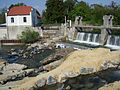
Scheibbs, view over the Erlauf weir towards the old town

Scheibbs, view towards the sand bridge

Scheibbs, view towards Töpperbrücke / Bürgerspital

Small Erlauf near Steinakirchen

Confluence of the small and large Erlauf
Taubinger power plant near Wieselburg

The Erlauf in the area of the rear gate walls; the rest of the water is led to the Erlaufboden power station via an underground pressure pipe


Individual evidence
- ↑ BMLFUW (Hrsg.): Area directory of the river areas: Danube area from the Enns to the Leitha. In: Contributions to Austria's hydrography, issue 62, Vienna 2014, pp. 41/148. PDF download , accessed July 8, 2018.