Wrong
| Wrong | ||
|
The mistake at Neufra |
||
| Data | ||
| Water code | EN : 1124 | |
| location |
Middle calf
|
|
| River system | Danube | |
| Drain over | Lauchert → Danube → Black Sea | |
| source | in Burladingen 48 ° 17 ′ 14 ″ N , 9 ° 6 ′ 44 ″ E |
|
| Source height | 721 m above sea level NN | |
| Spring discharge |
MNQ MQ MHQ |
10 l / s 500 l / s 1.35 m³ / s |
| muzzle | between Hettingen and Hermentingen from the right and from the northwest into the Lauchert coordinates: 48 ° 12 ′ 32 ″ N , 9 ° 13 ′ 20 ″ E 48 ° 12 ′ 32 ″ N , 9 ° 13 ′ 20 ″ E |
|
| Mouth height | approx. 637 m above sea level NN | |
| Height difference | approx. 84 m | |
| Bottom slope | approx. 4.8 ‰ | |
| length | 17.5 km | |
| Catchment area | 72.277 km² | |
The Fehla , or Vehla , (historically also Fehlbach ) is a tributary brook on the right side of the Danube tributary Lauchert on the Zollernalb in Baden-Württemberg .
source

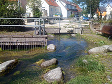
The source of the Fehla is only about one kilometer east of the European main watershed in the middle of the city of Burladingen, which is located in a west-east valley . Your above-ground run begins in the city center next to Josengasse . It rises here from a large karst spring that pours between 10 l / s and 1,350 l / s and an average of 500 l / s.
A secondary spring branch of the Starzel , which drains in the opposite direction to the Neckar, arises behind an inconspicuous valley watershed ( Strunkpass ) less than two kilometers further west in the same valley and joins its main branch in the western municipal area.
course

The stream flows eastward through the urban area of Burladingen and then changes to a very steady south-east course. On the 14 km straight line to the estuary, the Fehla flows mostly slowly, strongly meandering - especially between Gauselfingen and Neufra and then again two kilometers to Neufra. Shortly before its mouth, the stream and the small fish pond springs arising from the protected mass limestone geotope Enzenbarnfelsen feed the basins of a fish farm. Then the Fehla flows into the Lauchert a little south of Hettingen . It falls on its 17.5 km flow path by about 84 meters, so its mean bed gradient is 4.8 ‰. The catchment area on the surface covers 72.3 km².
natural reserve
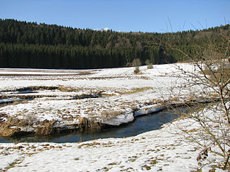
Two kilometers below Neufra, on its last three kilometers (as the crow flies), the Fehla meanders again strongly through the Fehlatal nature reserve, which is completely protected according to the NatSchG Baden-Württemberg . In order to curb water pollution from drugs and microplastics, the Burladingen sewage treatment plant is to be equipped with a fourth purification stage in the next few years. The completely car and train-free valley floodplain is very picturesque and a popular hiking destination.
Hydrogeology
Since the Alb landscape on both sides of the valley of the entire Fehla is completely karstified , only a single small spring comes up open over the entire course, four more are used to supply drinking water . Above-ground inlets are only available for a short time after heavy rain. Some dry valleys converge, the largest with over 6 km in length in Neufra from the right and west-north-west; In its uppermost section Teufelstal in the forest there is an approximately 0.1 hectare shell . On the last 3 km of the Fehlalauf in the nature-protected valley floodplain, around a quarter of the water seeps into the fissured karst rock (runoff measurements as of October 2003). Dyeing tests showed that the vanishing water as well as one kilometer below the fish pond sources of mouth further in the Gallus source its way back to, a large karst spring in lauchertabwärtigen Hermentingen.
References and comments
- ↑ Friedrich Huttenlocher : Geographical Land Survey: The natural space units on sheet 178 Sigmaringen. Federal Institute for Regional Studies, Bad Godesberg 1959. → Online map (PDF; 4.3 MB)
- ^ Layer water network ( AWGN ) on: State Institute for the Environment Baden-Württemberg (LUBW) ( information )
- ↑ Layer base catchment area ( AWGN ) on: Landesanstalt für Umwelt Baden-Württemberg (LUBW) ( information )
- ↑ Because of the karstification in the surrounding Alb, floors carrying groundwater below the surface catchment area defined here after the valley divide can drain in a different direction.
- ^ Cyriak Blödner : Theatrum Belli Rhenani (1702–1713), sheet 12. Reproduction of map H III d 344 of the Vienna War Archives by the State Surveying Office of Baden-Württemberg.
- ↑ LUBW profile of the nature reserve ( memento of the original from July 29, 2017 in the Internet Archive ) Info: The archive link was automatically inserted and not yet checked. Please check the original and archive link according to the instructions and then remove this notice.
- ↑ Maja Dick: Burladingen: The Fehla and her fish are helped. In: schwarzwaelder-bote.de . December 19, 2019, accessed December 20, 2019 .
- ^ Hydrogeological exploration of Baden-Württemberg, Mittlere Alb 2, Freiburg, LRGB 2004, p. 25
literature
- Topographic map 1: 25,000 Baden-Württemberg, as a single sheet No. 7620 Jungingen, No. 7621 Trochtelfingen, No. 7720 Albstadt and No. 7721 Gammertingen
Web links
- Run and catchment area of the Fehla on: State Institute for the Environment Baden-Württemberg (LUBW) ( information )
- Course and catchment area of the Fehla on: Geoportal Baden-Württemberg ( information )
- Measuring table sheets in the Deutsche Fotothek :
- 7620 Talheim / Jungingen from 1910
- 7621 Trochtelfingen / Undingen from 1910
- 7720 Ebingen / Burladingen from 1910
- 7721 Gammertingen (Preuss.) Mägerkingen (Württ.) From 1910


