
Fuga Island
| Fuga Island | ||
|---|---|---|
 |
||
| Waters | Strait of Luzon ( Philippine Sea ) | |
| Archipelago | Babuyan Islands | |
| Geographical location | 18 ° 53 ' N , 121 ° 23' E | |
|
||
| length | 22 km | |
| width | 6 km | |
| surface | 100 km² | |
| Highest elevation | Mount Nanguringan 191 m |
|
| Residents | 1786 (2007) | |
| main place | Barangay Fuga Island | |
 |
||

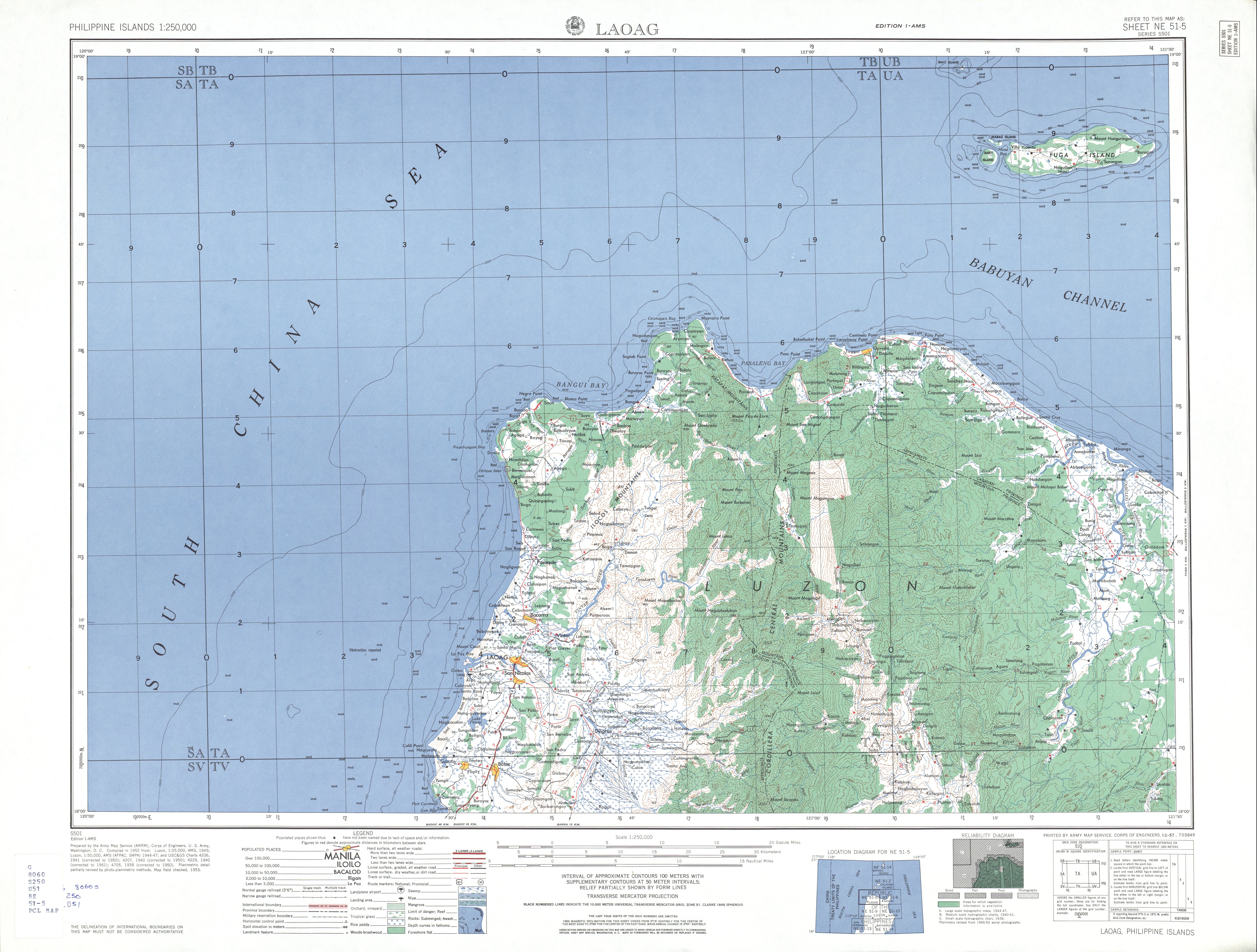
Fuga Island is the name of an island in the Cagayan Province of the Philippines . It belongs to the archipelago of the Babuyan Islands and is located about 40 km off the north coast of the island of Luzon , in the Luzon Strait . The island has an area of about 100 km² and is administered by the municipality of Aparri . On the island is the Barangay Fuga Island, which had 1786 inhabitants in 2007.
Fuga Island has a rectangular shape with a length of 25 km and a width of 5 km. The island's coastline is characterized by smaller bays. Musa Bay is located in the west of the island, with the small islands of Mabaag and Barit Island in front of it. The topography of the island is characterized by a flat, hilly landscape, in the northeastern center of the island on Mount Nanguringan, the terrain rises to 191 meters above sea level. The vegetation of the island consists partly of dense, tropical vegetation, but partly also of intensively agriculturally used areas.
To the northeast is Calayan Island about 40 km, to the north is Dalupiri Island about 23 km, to the east is Camiguin Island , 34 km from the island. The island can be reached via the port of Aparri.
See also
Web links
Individual evidence
- ↑ Statistical information from the NSCB ( Memento from November 14, 2012 in the Internet Archive )
- ↑ Topographic map of the island