Gelibolu
| Gelİbolu | ||||
|
||||
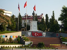
 Monument to Mustafa Kemal Ataturk with Turkish flags in the center |
||||
| Basic data | ||||
|---|---|---|---|---|
| Province (il) : | Çanakkale | |||
| Coordinates : | 40 ° 24 ' N , 26 ° 40' E | |||
| Residents : | 30,341 (2018) | |||
| Telephone code : | (+90) 286 | |||
| Postal code : | 17 500 | |||
| License plate : | 17th | |||
| Structure and administration (as of 2019) | ||||
| Structure : | 5 malls | |||
| Mayor : | Münir Mustafa Özacar ( CHP ) | |||
| Postal address : | Camikebir Mah. Eski Hükümet cad. No: 1 17500 Gelİbolu |
|||
| Website: | ||||
| Gelİbolu County | ||||
| Residents : | 44,809 (2018) | |||
| Surface: | 823 km² | |||
| Population density : | 54 inhabitants per km² | |||
| Kaymakam : | Hakan Kılınçkaya | |||
| Website (Kaymakam): | ||||
Gelibolu (verballhorn from Greek Καλλίπολις Kallipolis , Latin Callipolis ), also Gallipoli , is a Turkish port city on the Dardanelles on the Gallipoli peninsula (Turkish also Gelibolu ) in the province of Çanakkale . The city unites around two thirds of the district population (2018: 67.7%).
The ferry from Gelibolu to Lapseki is one of the main connections between Istanbul and Izmir , alongside the route via Eceabat - Çanakkale . There are a few sardine factories in town and the popular small hamsi fish ( anchovies ) are also sold.
district
The district was created in 1926, three years after Turkey was founded. In addition to the district town, it consists of another municipality ( Belediye ): Kavakköy with 2,721 inhabitants. There are also 26 villages ( Köy ) with an average of 365 residents. This is the highest value in the province of Çanakkale, the provincial average is 265 inhabitants per village. Bolayır has the largest population (1,141). The population density is slightly below the provincial average of 55 inhabitants per square kilometer.
history
The ancient Kallipolis was the counterpart to the Lampsakos on the south side of the Hellespont (Dardanelles), today's Lapseki. The city played a role especially in late antiquity because of its proximity to the capital, Constantinople . Of Justinian I , it became the fortress expanded.
The diocese of Kallipolis belonged to the ecclesiastical province of Heracleia . Of the six known Greek bishops, the first attended the Council of Ephesus in 431 and the last is mentioned after 1500. There were also eight Latin bishops between 1208 and 1508. Until the expulsion of the Greeks from the place in 1922 in the course of the population exchange with Greece , the place remained an Orthodox bishopric. The city is still the titular seat of a Greek Orthodox bishop and a Roman Catholic titular bishopric ( titular bishopric Callipolis ).
In 1354 the city was conquered by the Ottoman Sultan Orhan I. Gazi . During the reign of Sultan Bayezid I (1389-1402), the port of Gelibolu was expanded from 1390 as a naval base with a naval arsenal .
During the First World War , the Battle of Gallipoli took place here in 1915 , during which an Ottoman victory was achieved under Mustafa Kemal Pascha and Liman Pascha von Sanders .
Attractions
- ANZAC battlefields
- Ottoman fortress
literature
- Halil İnalcık : Gelibolu in: The Encyclopaedia of Islam. New Edition . Vol. 2, Brill, Leiden, p. 983.
Web links
Individual evidence
- ↑ a b Türkiye Nüfusu İl ilçe Mahalle Köy Nüfusları , accessed on June 1, 2019
- ↑ Raymond Janin, La hiérarchie ecclésiastique dans le diocèse de Thrace , in Revue des études byzantines , tomo 17, 1959, pages 148-149.
- ↑ Encyclopaedia of Islam , article on Gelibolu ( Memento of May 4, 2005 in the Internet Archive ) (II: 983a)


