Genivolta
| Genivolta | ||
|---|---|---|

|
|
|
| Country | Italy | |
| region | Lombardy | |
| province | Cremona (CR) | |
| Local name | Geniólta | |
| Coordinates | 45 ° 19 ′ N , 9 ° 52 ′ E | |
| height | 70 m slm | |
| surface | 18 km² | |
| Residents | 1,144 (Dec 31, 2019) | |
| Population density | 64 inhabitants / km² | |
| Post Code | 26020 | |
| prefix | 0374 | |
| ISTAT number | 019047 | |
| Website | Genivolta | |
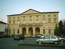
Genivolta is an Italian commune with 1144 inhabitants (as of December 31, 2019) in the province of Cremona in the Italian region of Lombardy .
location
Genivolta is located on Strada statale SS 498, 2 km west of the Isola Uccelanda nature park and 3 km southwest of the Riserva Naturale Bosco della Marisca . After Crema in the Northwest is 5 km and after Soresina km to the south. 4 The Autostrada 21 is 20 km to the east. Milan is 56 km northwest.
Festivals
The patronage of the place is St. Lawrence and is celebrated annually on August 10th.
Web links
Commons : Genivolta - collection of images, videos and audio files
Individual evidence
- ↑ Statistiche demografiche ISTAT. Monthly population statistics of the Istituto Nazionale di Statistica , as of December 31 of 2019.


