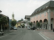
Spino d'Adda
| Spino d'Adda | ||
|---|---|---|

|
|
|
| Country | Italy | |
| region | Lombardy | |
| province | Cremona (CR) | |
| Local name | Spì | |
| Coordinates | 45 ° 24 ' N , 9 ° 30' E | |
| height | 84 m slm | |
| surface | 19 km² | |
| Residents | 6,882 (Dec. 31, 2019) | |
| Population density | 362 inhabitants / km² | |
| Post Code | 26016 | |
| prefix | 0373 | |
| ISTAT number | 019102 | |
| Website | Spino d'Adda | |
Spino d'Adda is a municipality with 6882 inhabitants (as of December 31, 2019) in the province of Cremona in the Italian region of Lombardy .
location
The place is located 5 km south of Rivolta d'Adda 2 km from the east bank of the Adda , the largest tributary of the Po in Lombardy, on the Strada Statale SS415, 19 km from the center of Milan. After Crema in the east is 17 km away and Lodi km to the south around the 10th
Districts
In addition to the main town, the municipalities (districts) Erbatico, Fornace, Fracchia-Fracina, Gamello and Resega are located in the municipality.
Web links
Commons : Spino d'Adda - collection of images, videos and audio files
Individual evidence
- ↑ Statistiche demografiche ISTAT. Monthly population statistics of the Istituto Nazionale di Statistica , as of December 31 of 2019.
- ↑ ISTAT - Dettaglio località abitate


