Glass mountain
| Glass mountain | ||
|---|---|---|
|
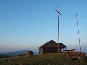
Dermbacher Hut on the Glass Mountain |
||
| height | 670.4 m above sea level NHN | |
| location | Thuringia , Germany | |
| Mountains | Rhön | |
| Coordinates | 50 ° 41 '33 " N , 10 ° 5' 57" E | |
|
|
||
| Type | Basalt breakthrough | |
| Normal way | Walk from Föhlritz | |
The glasses mountain or short glasses is 670.4 m above sea level. NHN high mountain near Föhlritz, a hamlet near Brunnhartshausen in the Thuringian part of the Rhön , a low mountain range in Bavaria , Hesse and Thuringia ( Germany ).
Geographical location
The Glass Mountain rises within the Wartburg district around 3 km southwest of the core town of Dermbach . The village of Föhlritz is located on the mountain slope about 700 m south of the glass. South to south-east of the mountain are the places Brunnhartshausen, Empfertshausen that in the valley of Felda located Neidhartshausen and Zella . A little further downstream and thus further north is the aforementioned Dermbach. The village of Steinberg is located west of the Glass Mountain .
history
As early as 1879, the Rhön Club built the first log cabin next to the summit cross . It comfortably seated 30 people and was inaugurated on August 17, 1879. On August 22, 1914, it was replaced by a successor building. The log cabin was rebuilt in 1994 by the Rhönklub , Dermbach branch, and inaugurated on October 3, 1994. The exposed location has its price - in 1998 the roof was re-covered with 35,000 larch shingles. The hut is managed and open on Sundays and public holidays from 10 a.m. to 5 p.m. In 2001 a display board was set up at the lookout point, on which the visible mountains and towns are shown as a guide.
Routes to the summit
- A road leads from Brunnhartshausen to Föhlritz, at the upper end of which there is a parking lot. From there, a relatively easy hiking trail runs for about 1 km to the top of the glasses with the Dermbacher hut.
- On the north side of the mountain, a path coming from Dermbach reaches the summit, the path from there runs past the Karl-Friedrich-Stein and the shepherd's drink.
- The Main-Werra-Weg (HSN) also leads over the Gläserberg.
Possibility of viewing
When visibility is good, these targets can be seen from the glasses mountain (sometimes only with binoculars):

- in the North
- the high Meissner
- the Monte Kali (a potash salt mountain) near Heringen
- the Baier and the place Oberalba
- in the East
- the Wartburg
- the Lindigshof near Dermbach
- the island mountain
- the pless
- the Horn (578 m high mountain)
- the Stopfelskuppe
- the dolmar
- in the south
- Neuberg and Roßberg
- the Umpfen with Fischbach at the foot of the mountains
- Diesburg , Leichelberg and Alte Mark
- Diedorf
- Zella , Empfertshausen , Klings
- in the West
- Kreuzberg , Heidelstein , Wasserkuppe and Milseburg protrude just above the ridge in front of it
More pictures
See also
Web links
- Dermbacher Hütte on rhoenklub.de
- View from the Glass Mountain on panorama-photo.net
literature
- Rhönklub (Ed.): Schneiders Rhönführer. Official guide of the Rhön Club, 2005, Parzeller Verlag, Fulda, ISBN 3-7900-0365-4 , p. 292
Individual evidence
- ↑ Map services of the Federal Agency for Nature Conservation ( information )
- ^ Regina Rinke: Rhön Club Huts in the Thuringian Rhön . In: Rhönklub (Ed.): Rhönwacht . No. 1 , 1991, ISSN 0936-1723 , pp. 18th f .


