Gmina Trąbki Wielkie
| Gmina Trąbki Wielkie | ||
|---|---|---|

|
|
|
| Basic data | ||
| State : | Poland | |
| Voivodeship : | Pomerania | |
| Powiat : | Gdański | |
| Geographic location : | 54 ° 10 ' N , 18 ° 32' E | |
| Residents : | see Gmina | |
| Postal code : | 83-034 | |
| Telephone code : | (+48) 58 | |
| License plate : | GDA | |
| Gmina | ||
| Gminatype: | Rural community | |
| Gmina structure: | 37 localities | |
| 25 school offices | ||
| Surface: | 162.62 km² | |
| Residents: | 11,098 (Jun. 30, 2019) |
|
| Population density : | 68 inhabitants / km² | |
| Community number ( GUS ): | 2204082 | |
| Administration (as of 2010) | ||
| Community leader : | Błażej concol | |
| Address: | ul.Gdańska 12 83-034 Trąbki Wielkie |
|
| Website : | www.trabkiw.ug.gov.pl | |
The Gmina Trąbki Wielkie is a rural community in the powiat Gdański of the Polish Pomeranian Voivodeship . Its seat is in the village of Trąbki Wielkie ( German Groß Trampken , Kashubian : Trąbczi Wiôldżé ).
structure
The rural community Trąbki Wielkie includes 25 places (German names up to 1945) with a Schulzenamt:
|
|
|
Other localities in the municipality are:
|
|
|
Neu Grenzdorf was a German place to live ; it was merged into the Graniczna Wieś Schulzenamt.
Attractions

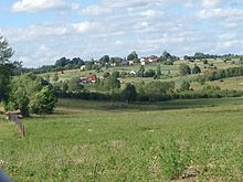
Błotnia , " Danzig Heights "
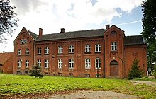
- Only a few remains of the Sobbowitz Castle ( Zamek w Sobowidzu ) have survived . This castle of the Teutonic Order was built at the beginning of the 14th century and a manor building was built over it in the 19th century.
Personalities
- Ignaz Stanislaus von Mathy (1765–1832), Roman Catholic bishop
- Alexander Graf von Kanitz, on Saskoschin and Dommachau (1848–1940) Prussian officer, lieutenant general and progenitor of the "Cappenberg line" of the Kanitz family
- Johannes Paul Aeltermann (1876–1939), Catholic priest in Meisterswalde since 1912, until his murder by the SS
- John Muhl (1879–1943), prosecutor, police officer and regional historian; born at Gut Lagschau
- Alexander Herzberg (1887–1944), physician, psychologist and philosopher; born in Sobbowitz
- Robert Wohlfeil (1889–1940), Catholic priest in Kladau from 1932–1939, perished in a concentration camp
- Adolf Wicht (1910–1996), Brigadier General of the Bundeswehr, press officer for the Federal Intelligence Service; born in Golmkau
- Harro Otto (* 1937), retired criminal law scholar; born in Sobbowitz.
literature
- John Muhl : History of the Villages on the Danziger Höhe. Gdansk 1938.
- John Muhl: History of the Sobbowitz Domain. In: Studies on the West Prussian history of goods. Gdansk 1925.
Web links
Commons : Gmina Trąbki Wielkie - Collection of pictures, videos and audio files
Footnotes
- ↑ population. Size and Structure by Territorial Division. As of June 30, 2019. Główny Urząd Statystyczny (GUS) (PDF files; 0.99 MiB), accessed December 24, 2019 .
- ↑ The Historical Place Directory
- ↑ www.westpreussen.de: Directory of places.

