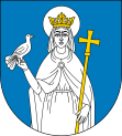
Gmina Tuchola
| Gmina Tuchola | ||
|---|---|---|

|
|
|
| Basic data | ||
| State : | Poland | |
| Voivodeship : | Kuyavian Pomeranian | |
| Powiat : | Tuchola | |
| Geographic location : | 53 ° 36 ' N , 17 ° 51' E | |
| Residents : | s. Gmina | |
| Postal code : | 89-500 + 89-501 | |
| Telephone code : | (+48) 52 | |
| License plate : | CTU | |
| Economy and Transport | ||
| Street : | Ext. 237 : Czersk –Mąkowarsko | |
| Ext. 240 : Świecie - Chojnice | ||
| DW 241 : Rogoźno - Więcbork - Czersk | ||
| Rail route : | PKP - Route 208: Działdowo-Chojnice | |
| Next international airport : | Gdansk Lech Walesa Airport | |
| Gmina | ||
| Gminatype: | Urban-and-rural parish | |
| Gmina structure: | 10 school offices | |
| Surface: | 239.43 km² | |
| Residents: | 20,270 (June 30, 2019) |
|
| Population density : | 85 inhabitants / km² | |
| Community number ( GUS ): | 0416063 | |
| Administration (as of 2006) | ||
| Mayor : | Tadeusz Kowalski | |
| Address: | Plac Zamkowy 89-500 Tuchola |
|
| Website : | www.tuchola.pl | |
The Gmina Tuchola is an urban-rural municipality in the powiat Tucholski in the Kuyavian-Pomeranian Voivodeship in Poland . The seat of the Powiat and the municipality is the city of the same name ( German Tuchel ) with around 13,800 inhabitants.
Geographical location
The community lies on the edge of the Bory Tucholskie (Tucheler Heide) in the former West Prussia . It borders in the north on the Pomeranian Voivodeship and the rural community Chojnice (Konitz) . The Brda (Brahe) runs a few hundred meters east of the city limits.
Partner communities
structure
The urban and rural community of Tuchola consists of the city and ten villages with school authorities and other small towns:
| Polish name | German name (until 1920 and 1939-1945) |
|---|---|
| Barlogi | Barlogi |
| Biała | Bialla ( 1942–1945 Bielen ) |
| Białowieża | Bialowierz ( 1942–1945 Belwers ) |
| Bielska Struga | Light flow |
| Bladowo | Bladau |
| Brody | Broddi |
| Dąbrówka | Dombrowka |
| Dziekcz | Dzeks |
| Jaty | Jatty |
| Kiełpin | Kelpin ( 1942–1945 Kelpen ) |
| Klocek | Klotzek ( 1942–1945 Klotzeck ) |
| Koślinka | Koslinka |
| Legbąd | Legbond |
| Łosiny | Lossini ( 1942–1945 Lossin ) |
| Lubierzyn | Lubierszyn |
| Mała Komorza | Klein Komorze ( 1942–1945 Kammergut ) |
| Mały Mędromierz | Klein Mangling Mill ( 1942–1945 Mangling Mill ) |
| Mrowiniec | Great Mrowinitz |
| Nadolnik | Niedermühl |
| Nowa Tuchola | New Tuchel ( 1942–1945 Neutuchel ) |
| Piszczek | Ernstthal |
| Plaskosz | Plaskau |
| Raciąski Młyn | Reetzermühle |
| Raciąż | Reetz |
| Rzepiczna | Rzepitno ( 1910-1919, 1939-1945 Repitz ) |
| Rudzki Most | Rudabrück |
| Słupy | Sluppi ( 1942–1945 Pfahldorf ) |
| Stobno | Stobno ( 1942–1945 Stübensee ) |
| Tuchola | Tuchel |
| Wielka Komorza | Groß Komorze ( 1942–1945 Waldkammer ) |
| Woziwoda | Woziwoda ( 1900-1919, 1939-1945 Schüttenwalde ) |
| Wysocki Młyn | Wittstockermühle |
| Wysoka | Wittstock |
| Wysoka Wieś | Hochdorf |
traffic
The Tuchola station is on the Działdowo – Chojnice railway line , where the disused Tuchola – Koronowo line branches off .
Personalities
- Roman von Janta-Polczynski (1849–1916), manor owner and member of the Reichstag; born in Groß Komorze
- Wiesław Szlachetka (* 1959), clergyman and auxiliary bishop in Danzig; born in Mała Komorza.
Web links
- City and municipality website (Polish)
Footnotes
- ↑ population. Size and Structure by Territorial Division. As of June 30, 2019. Główny Urząd Statystyczny (GUS) (PDF files; 0.99 MiB), accessed December 24, 2019 .
