Goryeong
| Goryeong gun | |||
|---|---|---|---|
| Korean alphabet : | 고령군 | ||
| Chinese characters : | 高 靈 郡 | ||
| Revised Romanization : | Goryeong gun | ||
| McCune-Reischauer : | Koryŏng-gun | ||
| Basic data | |||
| Province : | Gyeongsangbuk-do | ||
| Coordinates : | 35 ° 44 ' N , 128 ° 16' E | ||
| Surface: | 383.7 km² | ||
| Residents: | 34,122 (as of: 2019) | ||
| Population density : | 89 inhabitants per km² | ||
| Structure: | 1 eup, 7 myeon | ||
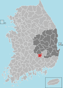
| map | |||
|
|||
Goryeong County ( Korean : 고령군 , Goryeong-gun ) is located in Gyeongsangbuk-do Province in South Korea . The administrative headquarters are located in the city of Goryeong-eup. The district had an area of 383.7 km² and a population of 34,122 inhabitants in 2019. The district is located west of the city of Daegu .
Goryeong is a historical center of the ancient Daegaya Kingdom .

Location of the county in Gyeongsangbuk-do
