Grambach
|
Grambach (former municipality) locality Grambach cadastral community |
||
|---|---|---|
|
|
||
| Basic data | ||
| Pole. District , state | Graz-Umgebung (GU), Styria | |
| Judicial district | Graz-East | |
| Coordinates | 47 ° 0 ′ 51 ″ N , 15 ° 30 ′ 13 ″ E | |
| height | 345 m above sea level A. | |
| Residents of the village | 1912 (January 1, 2020) | |
| Building status | 607 (2011 ) | |
| Area d. KG | 6.94 km² | |
| Postcodes | 8071, 8074 | |
| prefix | + 43/316 (Graz) | |
| Statistical identification | ||
| Community code | 60667 | |
| Locality code | 14933 | |
| Cadastral parish number | 63222 | |
| Counting district / district | Grambach (60667 001) | |
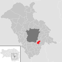
 Location of the former municipality in the Graz-Umgebung district |
||
| Independent municipality until the end of 2014 Source: STAT : Local directory ; BEV : GEONAM ; GIS-Stmk |
||
Grambach is a cadastral municipality and former municipality with 1912 inhabitants (inhabitants as of January 1, 2020) in Styria . As part of the municipal structural reform in Styria , it has been merged with the Raaba municipality since 2015 , the new municipality is called Marktgemeinde Raaba-Grambach . The basis for this is the Styrian Municipal Structural Reform Act - StGsrG. A complaint filed by the municipality of Grambach against the merger with the Constitutional Court was unsuccessful.
geography
Geographical location
Grambach is only about eight kilometers from the city center of Graz in the Graz-Umgebung district in the Austrian state of Styria .
Former parish structure
There were no other cadastral communities apart from Grambach.
Neighboring communities
| Raaba | Raaba | |
| Gössendorf |

|
Vasoldsberg |
| Gössendorf | Hausmannstätten | Vasoldsberg |
history
In 1265 Grambach was first mentioned in the registers of the Graz Marshal's Office. Until 1848 the place belonged to several manors like the dominions Liebenau, Messendorf-Hintenfeld, Münzgraben, Mühlegg, Schwarzenegg, Vasoldsberg, the upcoming Leech of the Kreuzerischen gilt, the Dominican Sisters of Graz, the Gut Kellerhof and the parish houses Hausmannstätten and Fernitz. The local community as an autonomous body was established in 1850. After the annexation of Austria in 1938, the community came to the Reichsgau Steiermark, 1945 to 1955 it was part of the British zone of occupation in Austria.
Population development
|
|
politics
Municipal council
The last mayor was Peter Gspaltl until 2014. After the 2010 elections, the municipal council was composed as follows:
coat of arms
Due to the amalgamation of the municipalities, the municipal coat of arms lost its official validity on January 1st, 2015.
Blazon (coat of arms description):
- "In the black and gold-edged red shield, three golden sticks broken in the middle oblique left."
At the end of the 19th century tree nurseries were founded in Grambach as special crops, which soon became the most important of the Austrian monarchy. The black and gold border of the coat of arms of the municipality of Grambach, the former imperial colors line the field of the coat of arms, like a fence that surrounds the garden. When the noble rice is placed on the base, it grows together to form a bush and tree. But rice brings growing life in its buds. Just as the wildling turns into a valuable tree only when the noble rice is attached, humans also ennoble their lives by doing good deeds. The symbolism of the coat of arms unites the importance of the place in the 19th and 20th centuries and, with the statement that a clean cut, nature can also live and survive in symbiosis with technology, builds a bridge to the future.
Culture and sights
Economy and Infrastructure
traffic
Grambach borders on the A 2 south autobahn , but direct access is not possible because there is no junction in this area. The closest is the Puchwerk junction on the Graz-Ost motorway feeder, about three kilometers away. The Unterkirchbacherstraße B 73 can in the neighboring Hausmannstätten be reached in about two kilometers.
There is no train station in town. The nearest train station is about two kilometers away in the neighboring town of Raaba and offers access to the Styrian Eastern Railway .
The Graz Airport is about ten kilometers away.
Web links
Individual evidence
- ↑ Statistics Austria: Population on January 1st, 2020 by locality (area status on January 1st, 2020) , ( CSV )
- ^ Styrian municipal structural reform .
- ↑ Section 3, Paragraph 3, Item 4 of the Act of December 17, 2013 on the reorganization of the municipalities of the State of Styria ( Styrian Municipal Structural Reform Act - StGsrG). Provincial Law Gazette for Styria of April 2, 2014. No. 31, year 2014. ZDB -ID 705127-x . P. 3.
- ↑ recognition of the Constitutional Court on 23 September 2014. G 47/14.


