Raaba
|
Raaba (Former Municipality) ( Capital of the Municipality ) Cadastral municipality of Raaba |
||
|---|---|---|
|
|
||
| Basic data | ||
| Pole. District , state | Graz-Umgebung (GU), Styria | |
| Judicial district | Graz-East | |
| Coordinates | 47 ° 1 ′ 41 ″ N , 15 ° 29 ′ 50 ″ E | |
| height | 350 m above sea level A. | |
| Residents of the stat. An H. | 2427 (January 1, 2016) | |
| Building status | 747 (2011 ) | |
| Area d. KG | 7.69 km² | |
| Post Code | 8074 Raaba | |
| prefix | + 43/316 (Graz) | |
| Statistical identification | ||
| Community code | 60667 | |
| Cadastral parish number | 63268 | |
| Counting district / district | Raaba (60 667 000) | |
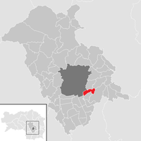
 Location of the former municipality in the Graz-Umgebung district |
||
| Independent municipality until the end of 2014; 15006 Dürwagersbach, 17574 Lamberg, 15007 Raaba, source: STAT : local directory ; BEV : GEONAM ; GIS-Stmk |
||
Raaba is a cadastral municipality and former market municipality with 2,427 inhabitants (residents as of January 1, 2016) southeast of Graz in the Graz-Umgebung district in Styria . As part of the municipal structural reform in Styria , it has been merged with the municipality of Grambach since 2015 , the new municipality is called Marktgemeinde Raaba-Grambach . The basis for this is the Styrian Municipal Structural Reform Act - StGsrG. A complaint filed by the Raaba community against the merger at the Constitutional Court was unsuccessful.
geography
Geographical location
Raaba is located on the Raababach directly on the southeastern outskirts of the provincial capital Graz in the eastern Styrian hill country at 350 to 506 m above sea level. The community belongs to the Graz Basin .
Community structure
The municipality comprised three villages (residents as of January 1, 2020):
- Dürwagersbach (181)
- Lamberg (251)
- Raaba (2332)
The community consisted of the only cadastral community Raaba.
Former neighboring communities
| Graz | Hard near Graz | Laßnitzhöhe |

|
||
| Gössendorf | Grambach | Vasoldsberg |
history
The local community as an autonomous body was established in 1850. After the annexation of Austria in 1938, the community came to the Reichsgau Steiermark, 1945 to 1955 it was part of the British zone of occupation in Austria. In 2000 Raaba was raised to a market town.
Population development
|
|
politics
Municipal council
The municipal council consisted of 15 members and was composed as follows after the 2010 elections:
mayor
The last mayor until 2014 was Karl Mayrhold (SPÖ), deputy mayor Werner Müller (SPÖ).
coat of arms
The municipal coat of arms was awarded with effect from July 1, 1987.
Blazon (coat of arms description):
- “In black, a golden diagonal right-hand bar, covered with four black wagon wheels abutting on all sides; the bar on both sides with a golden clover ledge. "
Culture and sights
Parks
The Life Park in 2000 created by the merger of the Bohemian parks with the garden spot of the grounds and has an area of about 11,000 sqm.
Economy and Infrastructure
traffic
Due to its proximity to Graz, Raaba is very conveniently located. The south autobahn A 2 runs directly through the area and can be reached in about one kilometer via the Puchwerk junction on the Graz-Ost autobahn slip road . The Unterkirchbacherstraße B 73 from Graz to Kirchbach in Steiermark is about four kilometers away.
In Raaba there is a Styrian Eastern Railway station , which offers hourly regional train connections to Graz and Gleisdorf . The central station Graz is about eight kilometers away. Raaba is connected to the bus network of Graz AG Verkehrsbetriebe .
The distance to the airport Graz is about seven kilometers.
Established businesses
The data center and other departments of Raiffeisen-Landesbank Steiermark , the Raiffeisenverband Steiermark, the Alpenländische Veredelungsindustrie (AVI), the Entwicklungs- und Verwertungs GmbH (EVG), the Hutter und Schranz Zauntechnik (H + S) and the Andritz Energy are located in Raaba & Environment .
literature
- Mag. Ingo Mirsch, Dr. Carol Veenstra: The story of a community . Available at the municipal office.
- Mag. Ingo Mirsch: Raaba 1849 - 2000 . Published on the occasion of the market survey. Available at the municipal office.
Web links
Individual evidence
- ↑ residents by locality (Excel file, 835 kB); accessed on August 29, 2016
- ^ Styrian municipal structural reform .
- ↑ Section 3, Paragraph 3, Item 4 of the Act of December 17, 2013 on the reorganization of the municipalities of the State of Styria ( Styrian Municipal Structural Reform Act - StGsrG). Provincial Law Gazette for Styria of April 2, 2014. No. 31, year 2014. ZDB -ID 705127-x . P. 3.
- ↑ recognition of the Constitutional Court on 23 September 2014. G 47/14.
- ↑ Statistics Austria: Population on January 1st, 2020 by locality (area status on January 1st, 2020) , ( CSV )
- ↑ Communications from the Styrian State Archives 38, 1988, p. 37


