
Hawk (mountain)
| hawk | ||
|---|---|---|
 |
||
| height | 3277 m above sea level A. | |
| location | Tyrol , Austria | |
| Mountains | Stubai Alps | |
| Dominance | 10.1 km → Eastern Seespitze | |
| Notch height | 553 m ↓ Simmingjöchl | |
| Coordinates | 47 ° 2 '37 " N , 11 ° 17' 22" E | |
|
||
| Type | Rocky peaks, partly glaciated | |
| rock | Mica slate | |
| First ascent | 1836 by PC Thurwieser and the Stubai I. Krösbacher | |
| Normal way | from the east ( UIAA I ) | |
 Goshawk from the northeast |
||
 The hawk from the southwest |
||

The Habicht (popularly also Hager or Hoger ) is a 3277 m above sea level. A. high mountain in the Stubai Alps in Tyrol , Austria .
topography
The Habicht lies between the Stubai Valley in the northwest, the Pinnistal , a side valley of the Stubai Valley in the east, and the Gschnitztal in the southeast. It is the highest point in the Habichtkamm , a mountain ridge that branches off from the main Alpine ridge near the Feuerstones and runs in a north-easterly direction to the Elferspitze . Its neighboring summit to the southwest is the 3133 m high Glättespitze , in the northeast is the 2833 m high Schaufelspitzl . In the east lies the Pinnisjoch ( 2370 m ), a transition between the Pinnis- and Gschnitztal, where the Serleskamm branches off from the Habichtkamm. The hawk carries three glaciers . North side, the steep Mischbach Furthermore, the small, northeast Pinnisferner embedded, southeast side is the flat hawk addition . There is also a small firn field below the southwest flank .
history
For a long time, the hawk, called "Hoger" by the locals, was considered the highest mountain in Tyrol due to its distinctive shape:
"The Hoger in Gschnitz,
the Waldraster Spitz
and the Martinswand are
the highest in the country."
Of all the high peaks of the Stubai, the Habicht was the first to be climbed for tourists, although local hunters and the surveyors' assistants had already been on the summit. Peter Carl Thurwieser found a stone man on the summit when he was climbing the mountain on September 1, 1836 . Together with the mountain guide Ingenuin Krösbacher from Fulpmes , you climbed from the Pinnisalm in the north to the Pinnisjoch , then in a westerly direction to the Speikgrathöhe and across a firn field and the Habicht-Ostgrat to the summit. According to Thurwieser, the walking time was three hours and 25 minutes. He stayed at the summit for four and a half hours, keeping records of the view and taking barometric readings. The descent was the same way.
ways
From the Innsbrucker Hütte on the Pinnisjoch, the Habicht is relatively easy to reach on the normal route ( UIAA I offices , insurance companies ). The path leads through the southeastern flank, the Habichtferner above is free of crevices, but may be aperous in late summer . Further climbs are the western north ridge (III), the Mischbachferner ( ice tour , 50 °), the eastern north ridge (IV), the northeast face (II), from the southeast (II), the southwest ridge (II) and the southwest pillar (IV +). In winter, if the conditions are safe, the Habicht can be climbed as a ski tour over the southwest flank or over the Mischbachferner.
gallery

From the north (Seeblasspitze)

The hawk remover

The hawk from the south with traces of ski tourers

From Steinach am Brenner

The Habicht with Starkenburger Hut in the foreground
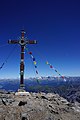
Summit cross of the hawk


Literature and map
- Walter Klier : Alpine Club Guide Stubai Alps. Munich 2006, ISBN 3-7633-1271-4 .
- Alpine Club Map 1: 50,000, Sheet 31/3 Brenner Mountains
Individual evidence
- ^ New magazine of the Ferdinandeum for Tyrol and Vorarlberg, Innsbruck 1840, p. 44 ff.
- ↑ Ludwig Purtscheller in: Eduard Richter : The development of the Eastern Alps , Berlin 1894, p. 417 ff.
Web links
- Habicht on Summitpost.org
- Ski tour from the south to the Habicht on alpenverein aktiv.com (German)