Hattula
| coat of arms | map |
|---|---|

|

|
| Basic data | |
| State : |
|
| Landscape : | Kanta-malice |
| Administrative community : | Hämeenlinna |
| Geographical location | 61 ° 3 ' N , 24 ° 22' E |
| Surface: | 427.39 km² |
| of which land area: | 357.84 km² |
| of which inland waterways: | 69.55 km² |
| Residents : | 9,475 (Dec. 31, 2018) |
| Population density : | 26.5 inhabitants / km² |
| Municipality number : | 082 |
| Language (s) : | Finnish |
| Website : | hattula.fi |
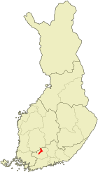
Hattula [ ˈhɑtːulɑ ] is a municipality in southern Finland with 9475 inhabitants (as of December 31, 2018). It is located in the Kanta-Häme countryside, 12 km north of the town of Hämeenlinna . To the north of Hattula lies the town of Valkeakoski . The distance to the capital Helsinki is 112 km.
geography
The community center of Hattula has 4000 inhabitants and is called Parola . The municipality also includes the places Hakinmäki, Halkkorpi, Hurttala, Hyrvälä, Ihalempi, Kalkkonen, Katinala, Kerälä, Kivijoki, Koski, Kouvala, Kärsälä, Leiniälä, Lepaa, Mervi, Metsänkylä, Mierola, Nihattula, Nummkola, Nummkola, Pyhälahti, Rahkoila, Saari, Sattula, Takajärvi, Tenhiälä, Valtee, Ventola, and Vuohiniemi.
The state roads 3 from Helsinki via Tampere to Vaasa and 10 from Turku via Hämeenlinna to Lahti cross in Hattula. The nature of the municipality is determined by five Osers , which run across Hattula, and the Vanajavesi Lake, which is traversed by the water system of the Kokemäenjoki River. Hattula is surrounded in three directions by the administrative city of Hämeenlinna, in the north the municipality borders on Valkeakoski and Pälkäne .
history
The parish of Hattula was probably created in the Middle Ages as part of the Christianization of the Häme region at the beginning of the 13th century. Hattula was first mentioned in a document in 1318. The political community of Hattula was established in 1868 when the administration of the rural communities was separated from the church administration. In 1971, the municipal area expanded through the incorporation of the municipality of Tyrväntö . While most of its neighboring communities were incorporated into the town of Hämeenlinna in 2009, Hattula opposed the planned incorporation. The municipality had to cede an area of 27 km² to Hämeenlinna in order to create a connection between Hämeenlinna and Kalvola .
Sons and daughters
- Magnus Wegelius (1884–1936), gymnast and marksman
- Niko Kapanen (* 1978), ice hockey player
- Antti Miettinen (* 1980), ice hockey player
Attractions
The Holy Cross Church in Hattula dates from the late 15th century and is the oldest church in the Häme region . It is noteworthy that, unlike most of Finland's medieval churches, it is not made of field stones, but of brick. The church is decorated with wall paintings from the 16th century and was a place of pilgrimage before the Reformation. The new church from 1857 is also made of brick.
The largest employer in the municipality is the tank brigade of the Finnish army stationed in Parolannummi . Hattula's military tradition is also maintained by the Tank Museum, which opened in 1961 .
Web links
Individual evidence
- ↑ Maanmittauslaitos (Finnish land surveying office): Suomen pinta-alat kunnittain January 1, 2010 . (PDF; 199 kB)
- ↑ Statistical Office Finland: Table 11ra - Key figures on population by region, 1990-2018
