Hohe Warte (Karwendel)
| High wait | ||
|---|---|---|
|
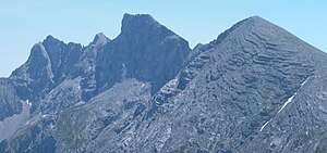
The Hohe Warte with the striking south ridge in the middle of the picture, the Kleine Solstein on the left, the Hintere and Vordere Brandjochspitze from Innsbruck on the right |
||
| height | 2597 m above sea level A. | |
| location | Tyrol , Austria | |
| Mountains | Nordkette , Karwendel | |
| Dominance | 0.4 km → Hintere Brandjochspitze | |
| Notch height | 85 m ↓ notch to the Hinteren Brandjochspitze | |
| Coordinates | 47 ° 18 '6 " N , 11 ° 20' 2" E | |
|
|
||
| rock | Wetterstein lime | |
| Age of the rock | Triad | |
| First ascent | 1870 by Hermann von Barth | |
| Normal way | Innsbruck - Seegrube or Aspachhütte - Gamswartsattel - Hohe Warte | |
|
From the left Hintere Brandjochspitze , Hohe Warte, Kleiner Solstein , Großer Solstein |
||
The Hohe Warte is 2597 m above sea level. A. high mountain in the Karwendel . It is located between the Kleiner Solstein in the west and the Hinteren Brandjochspitze in the east in the Nordkette in the Karwendel in the Austrian state of Tyrol , north of the Innsbruck district of Kranebitten and has a notch height of around 85 meters.
Development
The Hohe Warte was first climbed in 1870 by Hermann von Barth . Today's normal route to the summit leads from the Aspachhütte ( 1534 m above sea level ) above Innsbruck without major difficulties in the rock through rugged terrain to the Gamswartsattel , then briefly over the west ridge to the summit. Another ascent leads over the south ridge with difficulty UIAA IV . Transitions to the Kleiner Solstein and the Hinteren Brandjochspitze are possible in difficulty level III-.
gallery
Literature and map
- Walter Klier : Alpine Club Guide for the Karwendel Mountains Alpine . 15th edition. Bergverlag Rother , Munich 2005, ISBN 3-7633-1121-1 .
- Alpine Club Map 1: 25,000, sheet 5/1, Karwendel Mountains West
Individual evidence
- ^ Federal Office for Metrology and Surveying Austria: Austrian Map online (Austrian map 1: 50,000) . Retrieved February 13, 2012.
- ↑ Heinrich Schwaiger in Eduard Richter : The development of the Eastern Alps , Volume I, Berlin 1893, p. 224
- ^ Walter Klier: Alpenvereinsführer alpin, Karwendel , p. 142 f, Rz 730 ff.


